
Just about everyone is familiar with mapping apps on mobile phones. In fact, most of us probably use one on a weekly, if not daily, basis. These mobile applications are a type of Geographic Information System (GIS). The roads, imagery, restaurants, gas stations, and other information available are all different GIS datasets. These datasets make it possible to zoom in to The Woodlands, search for ‘restaurants,’ and then populate various restaurant locations on the map. The data also enables the user to see the establishment’s name, address, reviews, and other useful information. Most people don’t realize they have been using GIS for years.
GIS is a technology field that has been around since 1968. GIS utilizes the location, or geography, of objects/features and the information associated with those objects/features for mapping and analysis. So how is GIS being used by an organization like the San Jacinto River Authority (SJRA)? Geographic tells us the where – location of a water line, dock, or siphon. Information tells us the details – diameter of a water line, owner of the dock, or name of the siphon. Systems are the computers, software, data, and people needed to build the data, run the analysis, create the map, and support the users. SJRA has four GIS professionals on staff who are responsible for building and maintaining data for our Operational Divisions. The datasets and the information associated with them are used in various ways. By using GIS, SJRA can map locations of various assets. For example, the SJRA Woodlands Division operates and maintains three regional wastewater treatment plants, a wastewater conveyance system, five water plants, 38 water wells, six elevated storage tanks (ESTs), eight ground storage tanks, and hundreds of miles of wastewater collection and potable water distribution lines. GIS allows a technician or water operator to locate specific assets for routine maintenance or potential repair. Technicians can look at the valve dataset to find where a particular valve is located and confirm the size prior to a repair allowing staff to be proactive by loading the proper equipment on the truck before leaving the shop, saving time and money.
SJRA also utilizes GIS in preventing future erosion and extensive damage. The Lake Conroe Division uses GIS for internal data collection, associated with those objects/features for mapping and analysis. So how is GIS being used by an organization like the San Jacinto River Authority (SJRA)?
Geographic tells us the where – location of a water line, dock, or siphon.
Information tells us the details – diameter of a water line, owner of the dock, or name of the siphon.
Systems are the computers, software, data, and people needed to build the data, run the analysis, create the map, and support the users.
SJRA has four GIS professionals on staff who are responsible for building and maintaining data for our Operational Divisions. The datasets and the information associated with them are used in various ways. By using GIS, SJRA can map locations of various assets. For example, the dropping points such as animal damage or erosion issues onto a map which allows technicians to accurately map and plan repairs and note trouble spots while out in the field. In SJRA’s Highlands Division, GIS is used for assessing the Highlands canal system for levee improvements, vegetation clearing, and new access gates. The collected data is instrumental in mapping future projects and planning budget expenditures.
Most internal and external presentations, studies, reports, as well as the SJRA 10-Year Project Plan use GIS to help visualize projects. GIS is also useful for public education campaigns to show SJRA’s work sites within a community and convey complicated topics or messages in a more creative and easy to understand way than words alone.
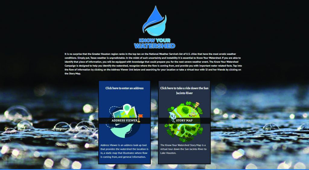
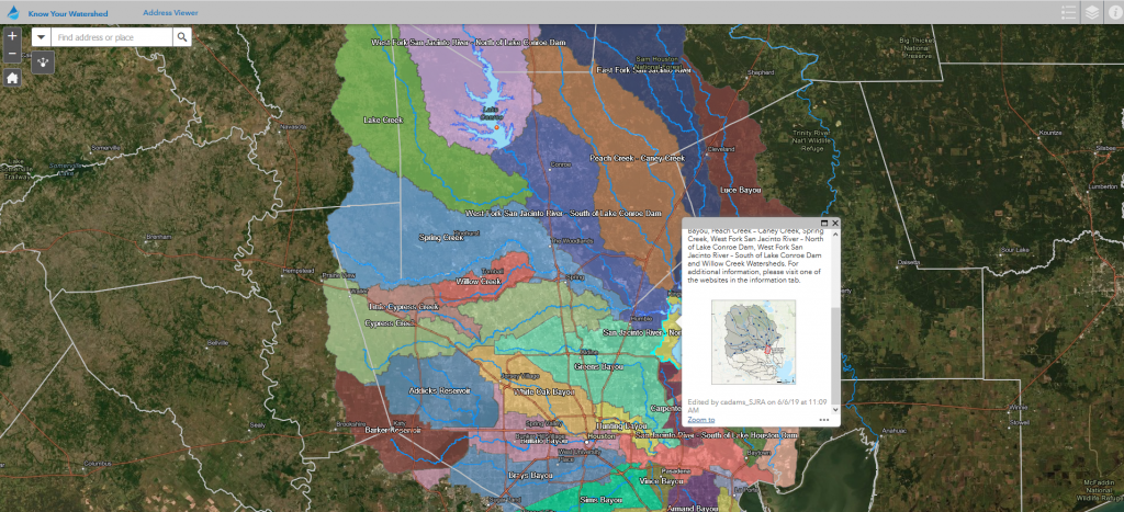
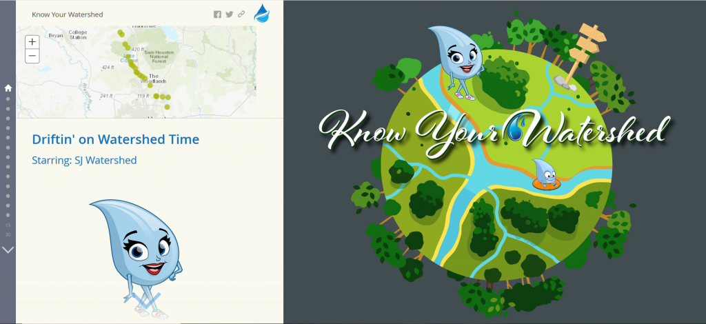
Two ways SJRA is using GIS for public education is through the Know Your Watershed campaign and operational Story Maps. Know Your Watershed (www.KnowYourWatershed.com) is an interactive website designed to educate San Jacinto River Basin residents by engaging them in 1) identifying their watershed 2) recognizing flow patterns 3) observing how water naturally drains throughout the basin, and 4) learning important water-related facts in a creative and entertaining way. Viewers can access information by clicking on an “Address Viewer” link and searching for their location, or take a virtual tour with perky public viewer to track mowing and maintenance schedules on line this summer.
Created in 1937 by a special act of the Texas Legislature, the San Jacinto River Authority’s (SJRA) mission is to develop, conserve, and protect the water resources of the San Jacinto River basin. From managing Lake Conroe to providing water and wastewater services in The Woodlands to operating a water treatment plant designed to reduce reliance on water drop SJ Watershed and her friends by clicking on the “Story Map” which features fact sheets, animation, and videos.
On SJRA’s website www.sjra.net viewers can take a virtual tour of the GRP water treatment plant or type in their address to see if they are conserving our aquifers by receiving treated surface water from Lake Conroe. SJRA has both water and wastewater virtual tours of their Woodlands facilities coming this spring. SJRA Highlands will have a underground aquifer water supply, SJRA has grown from a small agency that primarily helped farmers construct stock tanks for water and soil conservation to a community partner with five distinct operating divisions throughout the San Jacinto River basin. SJRA’s operational divisions—Lake Conroe, Woodlands, Highlands, Groundwater Reduction Plan, and Flood Management—serve the community through municipal and industrial water supply, wastewater treatment, water quality management, and flood mitigation strategies.
One of the major river authorities in Texas, SJRA’s mission is to develop, conserve, and protect the water resources of the San Jacinto River basin. Covering all or part of seven counties, the organization’s jurisdiction includes the entire San Jacinto River watershed, excluding Harris County. For additional information on SJRA visit our website at www. sjra.net, like SJRA on Facebook @SanJacintoRiverAuthority, follow us on Twitter @SJRA_1937, or find us on Instagram @SanJacintoRiverAuthoritySJR
SJRA Board of Directors Recommends Renewing Flood Mitigation Strategy
San Jacinto River Authority (SJRA) Board of Directors last month approved a recommendation to the City of Houston (COH) to continue a temporary flood mitigation program at Lake Conroe. The board’s vote proposed extending the initiative through December 2022 and serves as a recommendation to the City of Houston who owns the majority of the water rights in Lake Conroe.
At the special board meeting, over 100 constituents voiced their opinions on the initiative to reduce water level in Lake Conroe on a seasonal basis to create extra capacity to catch rainfall and storm water runoff. During the meeting SJRA Director of Water Resources and Flood Management, Chuck Gilman, gave a presentation to the board that included 20 years of rainfall and lake level data for consideration.
The SJRA Board of Directors approved the following recommendation to the COH regarding the operation of Lake Conroe:
- Spring strategy: Beginning April 1, release only an amount of water from Lake Conroe to create a one foot capacity to catch rainfall and storm runoff (from 201’ mean sea level to 200’ msl). Recapture of lake level beginning June 1.
- Fall strategy: Beginning August 1, release only an amount of water from Lake Conroe to create a one foot capacity to catch rainfall and storm runoff (from 201’ msl to 200’ msl). After September 1, increase capacity an additional six inches (from 200’ msl to 199.5’ msl). If a named storm is predicted to impact our region, the COH may initiate an additional release of six inches (to 199’ msl) by notifying SJRA in writing of their call for release. Recapture beginning October 1.
- All releases come from the COH’s 2/3 share of permitted water supply in Lake Conroe at the city’s request. SJRA staff to coordinate with COH staff on the details and timing of any releases.
- If the lake level of Lake Conroe has already dropped to the target elevation due to natural evaporation, no releases should be made.
The strategy of temporarily creating capacity in Lake Conroe on a seasonal basis began in 2018 to provide flood mitigation benefits for regional downstream constituents in both Montgomery County and Harris County by catching rainfall and runoff in Lake Conroe.


