Growth Isn't Moving in One Direction. It's Moving in Several at Once.
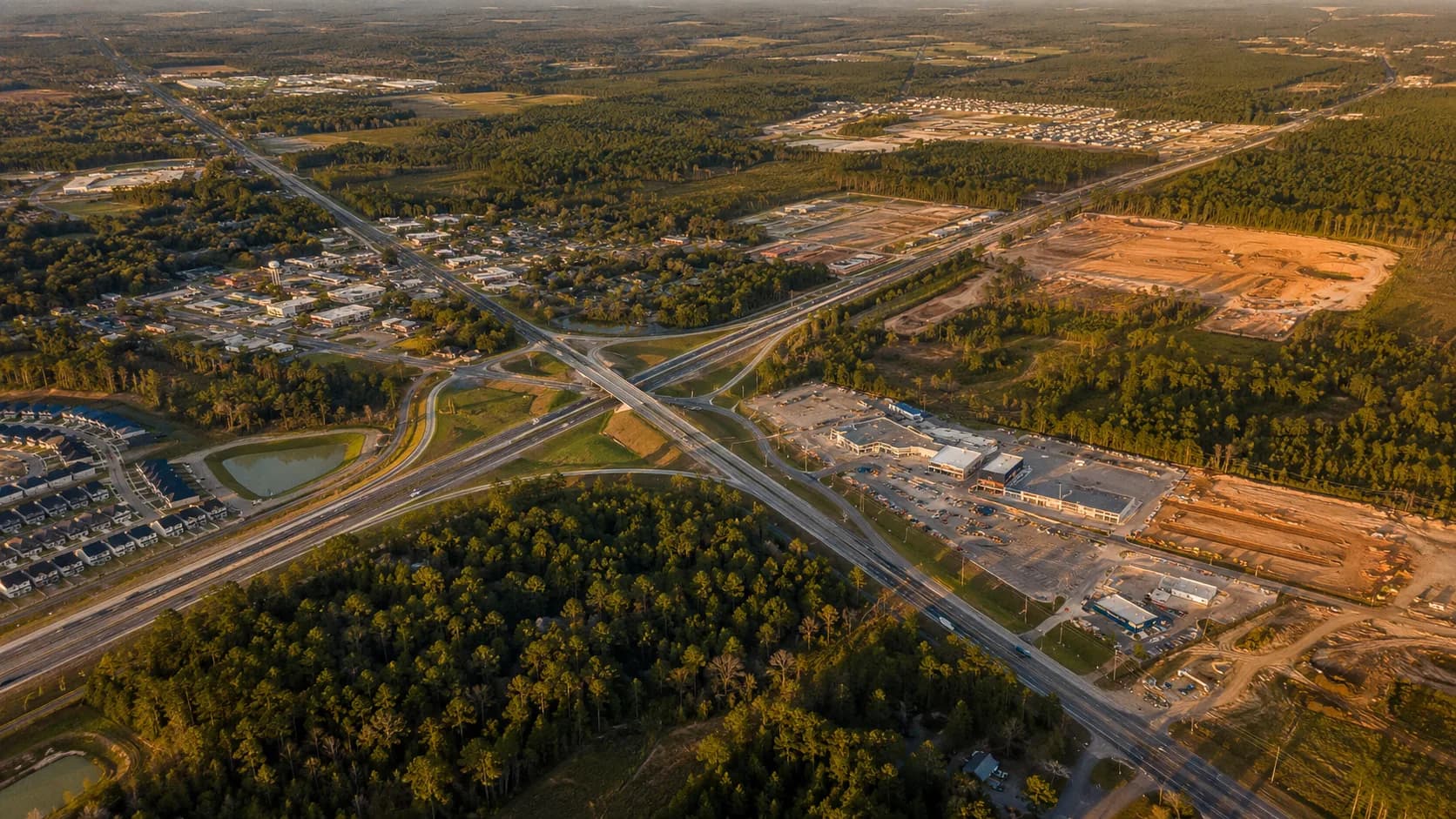
The growth map no longer has one arrow. Named communities, road projects and major retailers reveal five separate corridors developing around Lake Conroe.
The growth map no longer has one arrow. Named communities, road projects and major retailers reveal five separate corridors developing around Lake Conroe.
For years, anybody asked where Houston-area growth was headed could give a one-word answer: north. It came up Interstate 45 through Spring and The Woodlands, reached Conroe, pushed toward Willis and kept going. On a map, the story looked almost like one straight arrow.
That answer is no longer wrong. It is simply too small.
Stand near Lake Conroe today and the direction changes with the road you choose. Take State Highway 249 toward Magnolia and entire communities are rising from the piney woods. Follow Highway 105 west and new rooftops are being answered by major stores and another long-range community. Stay on I-45 north and Willis is beginning to look less like a stop between places and more like a destination of its own. Go east on Highway 242 or FM 1314 and thousands of planned homes are remaking another edge of Conroe. Continue northeast on FM 3081 and even the San Jacinto County line is becoming part of the conversation.
Growth used to look like one arrow. Now it looks like several arrows leaving the same dot.
The map has stopped giving one answer
Montgomery County's growth is large enough to spill in more than one direction. The U.S. Census Bureau estimated 781,194 residents in the county as of July 1, 2025—about 161,000 more people than the 2020 estimate base, a 25.9 percent increase in five years. Those people did not all move into the same city, the same kind of house or the same commuting pattern. Some wanted a subdivision close to a toll road. Some wanted acreage and trees. Some followed schools, jobs or family. Others could work partly from home and trade a longer drive for more land.
Developers followed those choices, but they also followed something less romantic: pavement, water, sewer capacity, drainage and electricity. A beautiful piece of land does not become a functioning community because somebody draws streets on a brochure. The infrastructure decides how fast the drawing can become real.
That is why the clearest growth map is not a city-limits map. It is a map of SH 249, FM 1486, FM 1488, Highway 105, FM 2854, FM 1097, FM 830, Highway 242, FM 1314 and FM 3081.
Northwest: The Aggie Expressway changed Magnolia's distance

Magnolia did not move closer to Houston. State Highway 249 changed what "far away" meant. The Aggie Expressway gave the northwest side a faster connection toward Tomball, the Grand Parkway and the rest of the Houston region. Land that once felt removed from the daily commute became more practical. The scale of the communities now attached to that corridor shows what followed.
Kresston sits near SH 249 and FM 1486. Its developer describes a roughly 1,400-acre community planned for more than 3,500 homes, with future retail and an on-site Magnolia ISD campus. That is not a small subdivision tucked behind a country road. At full buildout, it is a new piece of town.
Audubon, near SH 249 and FM 1488, is already expanding through a third district called Heron Run. Plans announced in 2025 called for about 1,424 homesites in that district, with an initial 821 lots expected across 2025 and the first half of 2026. Magnolia Woods adds another long-range plan for more than 1,300 single-family homesites, while Sherbrooke, off FM 1488 near Magnolia, has been planned for hundreds more.
Put those names on the same map—Kresston, Audubon, Magnolia Woods and Sherbrooke—and the northwest pattern becomes difficult to miss. It is not one neighborhood causing growth. It is a corridor creating room for several neighborhoods at once.
That does not mean every planned house will appear tomorrow. "Full buildout" can take years, markets change and development schedules move. But thousands of planned lots affect school sites, turn lanes, emergency coverage, water systems and commercial decisions long before the last roof is built. Magnolia's recent struggles over water capacity and development timing made that lesson plain. Roads can make land reachable. Utilities determine how much growth the land can actually carry.
West: Montgomery's stores are catching up with its rooftops

West of Conroe, Highway 105 has carried residential growth for years. Now the commercial side is beginning to answer. An H-E-B of roughly 127,000 square feet is planned for the southeast corner of Highway 105 and FM 2854, with an anticipated opening in late 2026. Academy Sports + Outdoors has also been announced along C.B. Stewart Drive near Ransom's Steakhouse & Saloon.
Those are more than two store announcements. Large retailers study rooftops, traffic counts and future households before committing to a location. Their arrival says the population west of Conroe is no longer being treated as scattered lake traffic. It is being treated as a permanent market.
The residential map supports that conclusion. Homeplace is a planned community of roughly 2,100 acres bounded generally by Highway 105, FM 2854, FM 149 and the area around Lake Creek High School. Its first lots are expected to reach builders in 2027. Berryknoll, along FM 2854, has been planned for about 250 homes. Briarley, off Old Plantersville Road near Highway 105, adds another large tract to the same general movement.
The direction is not simply "west." It is outward from the Highway 105 spine into the roads that connect Montgomery, the lake and the country beyond it. That will bring conveniences many residents have wanted. It will also bring more daily trips through intersections that were not designed for a town several times larger than the one people remember. Sewer projects, lift stations, drainage work and utility planning will be just as important as the new grocery aisles. Montgomery is reaching the phase when the stores follow the houses—and the public systems have to catch both.
North: Willis may feel the change fastest
Willis still looks like Willis in many places. That may be exactly why each new project is so noticeable. The Census Bureau estimated 7,652 residents in the city in 2025, up 19.4 percent from the 2020 estimate base. The number is modest beside Conroe, but the rate of change is not. A few hundred new households can alter traffic, schools and shopping patterns quickly in a smaller city.
The intersection of I-45 and FM 1097 is becoming the most visible proof. State project filings identify new retail construction at Market at Willis on the southeast corner, including a PetSmart buildout. A Chuy's project has also been registered for the same general intersection, along with additional retail shells. Other restaurant and retail names continue to appear in filings and announcements.
Filings are plans, not promises. Dates can move and tenants can change. Even so, the direction is clear: businesses expect more people to live, shop and eat north of Conroe. The rooftops are already spreading around them. The roughly 2,000-acre Woodlands Hills community sits west of I-45 along FM 830, with boundaries reaching north toward FM 1097 and south toward League Line Road. Castle's Edge has brought hundreds of planned homesites to the Willis area. Additional neighborhoods are filling the spaces between the highway, the lake and older rural roads.
Then comes the pavement. FM 1097 has been widened from two lanes to four, with a continuous left-turn lane between west of Blueberry Hills Road and Lake Conroe Hills Drive. Work has also been underway at Atkins Creek, and another stretch from Highway 75 in Willis toward the Walker County line entered an improvement schedule in 2026.
That road work is both a response and a forecast. It responds to the traffic already there. It forecasts the traffic everybody expects next. Willis may not add the largest number of homes in the region, but it may experience the sharpest before-and-after feeling. When a town is smaller, every new turn lane, shopping center and neighborhood changes a larger share of the picture.
East and southeast: Conroe is still expanding, but differently
Conroe remains the hub in the middle of all these arrows. It continues to add people, homes, medical services, government offices and retail. But its next phase is not confined to the familiar I-45 corridor. East and southeast Conroe are becoming a major residential front of their own.
ARTAVIA is a 2,800-acre master-planned community with its main entrance on Highway 242. In 2025, it opened another entrance on FM 1314 and extended ARTAVIA Parkway, giving residents a route only about five miles from the Grand Parkway. Evergreen occupies 740 acres at the northwest corner of FM 242 and FM 1314. Together with other active communities along Highway 242, those projects are turning a once-rural road network into a residential corridor connecting I-45, US 59 and the Grand Parkway.
The roads inside Conroe are changing too. Highway 105 is being widened between 10th Street and South Loop 336. A direct connector from northbound I-45 to eastbound Highway 242 is under construction. Farther south, Montgomery County approved an agreement in early 2026 to move forward with the long-discussed expansion of Old Conroe Road from Loop 336 South to FM 1488, including a new bridge across the San Jacinto River. A construction date has not yet been set, but planners project traffic on that route will more than triple by 2045.
Conroe is not being passed by as growth moves elsewhere. It is becoming the place that connects the directions—the employment and service center between Magnolia's northwest expansion, Montgomery's westward buildout, Willis's northern transformation and the eastern communities tied to Highway 242. The city's challenge is that being the hub means carrying traffic generated well beyond its own city limits.
Northeast: The first step beyond the county line

The quietest arrow may become the most interesting one. Northeast of Willis, FM 3081 reaches into San Jacinto County through country that still feels distinctly rural. The roads are narrower, the trees are thicker and the distance between driveways grows. Nobody should mistake it for another Conroe waiting to happen next month.
But Foster Creek Ranch is an early signal that the acreage market is moving across the county line. Its first phase covers more than 1,500 acres and is planned for more than 600 lots, generally two to four acres each. The developer says the full project could eventually reach more than 5,000 acres, with asphalt roads, underground electricity, fiber and water availability planned for the homesites.
That is a different kind of growth from Magnolia Woods or a retail center at I-45. It is not density moving outward. It is people searching farther out for room, trees and quiet while still wanting reliable internet, utilities and access to Willis, Conroe and the Houston region.
Coldspring and the communities around Lake Livingston are not about to become suburbs overnight. The Sam Houston National Forest, longer drives, limited road networks and the cost of infrastructure all slow the change. Those limits are part of what protects the character people are moving there to find. Still, the first large projects matter. They show where the pressure may go after the closest land becomes more expensive or more crowded. The county line is a government boundary. It is not a wall around the housing market.
The roads tell the story before the population numbers do
Growth rarely arrives in a neat order. Sometimes a road makes development possible. Sometimes thousands of new residents make a road project unavoidable. Sometimes homes appear before stores. Sometimes stores are announced before the nearby houses are finished. Schools must buy land years before anybody knows exactly how many children will arrive or which neighborhood will fill first.
That uneven timing is why a place can feel overbuilt and underserved at the same time. A resident may see rooftops going up while sitting in traffic on a two-lane road. A city may approve a major development while waiting for water capacity. A school district may open a campus where the children are expected, then watch mortgage rates or construction delays change the schedule.
The large numbers in development announcements need the same context. A plan for 3,500 homes is not a claim that 3,500 moving trucks are coming this year. It describes the eventual scale if the market, infrastructure and approvals cooperate. But it also tells public officials what they must begin thinking about now. The road project is not separate from the housing story. The lift station is not separate from the grocery store. The school site is not separate from the subdivision sign. They are all parts of the same map.
Several directions, one regional consequence
There is no single winner in this next stage of growth, and there is no single place absorbing all of it. Magnolia has the deepest pipeline of large new residential communities. Montgomery is seeing major retail catch up with years of housing. Willis may undergo the most visible transformation in the shortest distance. East Conroe is creating another major connection between I-45, US 59 and the Grand Parkway. The northeast edge is beginning the slower transition from remote acreage to connected rural living.
Each direction offers something people want: a shorter trip to the grocery store, a new school, more choices for housing, a larger tax base, a chance to live near the woods without giving up every modern connection. Each direction also asks something of the place receiving it: wider roads, reliable water, drainage, emergency services, classrooms and the discipline to protect what made the place attractive before the growth arrived.
That may be the most important point. Growth is not only a count of houses. It is a test of timing. The next question around Lake Conroe is no longer where growth is going—we can already see it moving northwest on SH 249, west on Highway 105, north on I-45 and FM 1097, east on Highway 242 and FM 1314, and northeast along FM 3081. The question is whether each road, water line, classroom and town square can arrive before the next roof does.