What Is Being Built on All That Bare Land Along FM 1488?
Part 1: The huge cleared tract along FM 1488 looks sudden. Public records show Longleaf has been moving through planning, platting and land deals for far longer than the bare ground suggests. Part 2 follows the infrastructure, taxes and money behind the growth.
Part 1: The huge cleared tract along FM 1488 looks sudden. Public records show Longleaf has been moving through planning, platting and land deals for far longer than the bare ground suggests. Part 2 follows the infrastructure, taxes and money behind the growth.
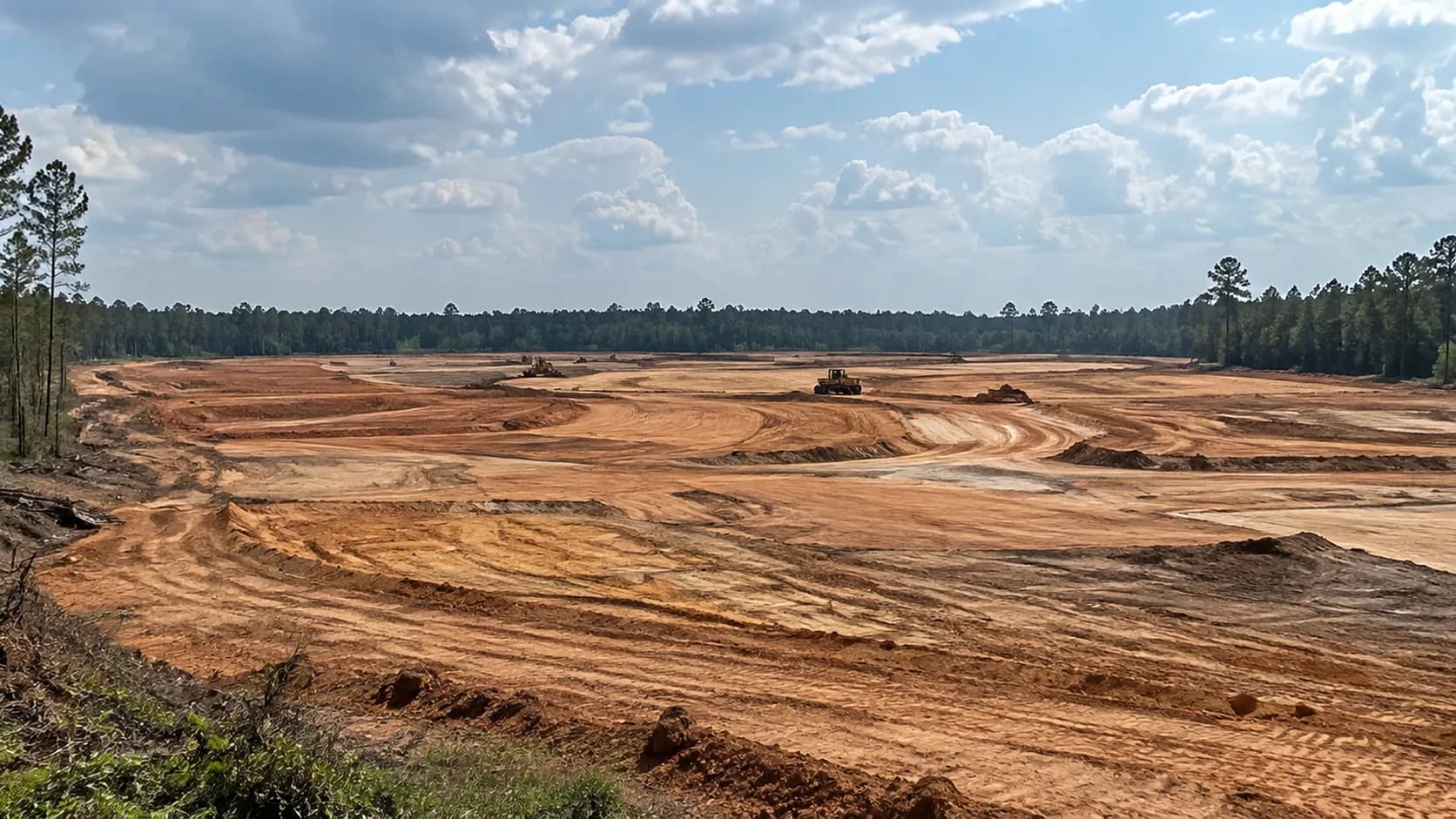
Drive FM 1488 near Magnolia and it is hard not to notice the change. Where trees and brush once filled the view, there is now a broad sweep of exposed earth — graded ground, construction lanes and the unmistakable look of a large development getting ready to rise.
The first question is the obvious one: What is being built on all that bare land?
The answer is bigger than a single row of houses or one apartment project. Public records point to the broader Longleaf development area south of FM 1488 and east of Spur 149. The plans include three Longleaf subdivision sections, while a separate state filing identifies a multifamily component called Ascend at Longleaf along the FM 1488 frontage.
That helps explain why the view from the road is confusing. A driver sees one enormous cleared landscape. On paper, the area is divided among sections, reserves, survey abstracts and adjoining parcels. A single photograph can easily look across more than one piece of the project at the same time.
This is Part 1 of a two-part Dock Line investigation. Today we look at what is being built and how long it has really been in motion. In Part 2, we follow the roads, utilities, taxes and the money.
Start With the Size
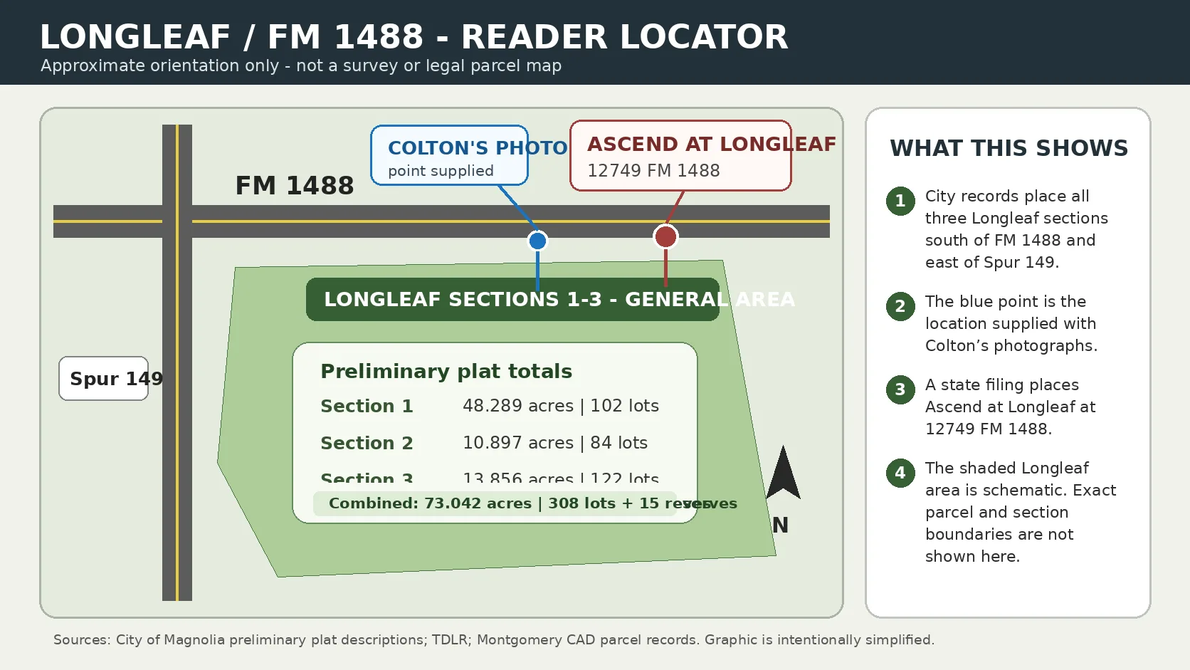
The City of Magnolia's June 2025 Planning and Zoning packet describes three preliminary plats for Longleaf, all located south of FM 1488 and east of Spur 149 in the city's extraterritorial jurisdiction.
Longleaf Section 1: 48.289 acres, 102 lots, 11 reserves
Longleaf Section 2: 10.897 acres, 84 lots, 2 reserves
Longleaf Section 3: 13.856 acres, 122 lots, 2 reserves
The three preliminary plats total 73.042 acres, 308 lots and 15 reserves. What looks from the highway like somebody simply stripped a huge tract is, in the planning documents, a project measured in dozens of acres and hundreds of lots.
The Project Was Moving Before the Dirt Was Bare
The visible clearing is recent. The paper trail is not.
Longleaf Section 1 was already on a Magnolia Planning and Zoning agenda in January 2025. By June 2025, the city packet included preliminary plat reviews for Sections 1, 2 and 3. The project was moving through the public planning process well before the current landscape became impossible to miss from FM 1488.
The June review comments are the kind of details most drivers never see: utility easements, private detention and drainage, building setback lines, right-of-way dimensions, 911 addressing and ties from proposed subdivision streets back to FM 1488. Those details do not make for dramatic roadside photographs, but they show how much work happens before a neighborhood begins to look like a neighborhood.
Then Came the 73-Acre D.R. Horton Deal
In May 2026, Newcor Commercial Real Estate announced that D.R. Horton had acquired 73 acres along FM 1488 from KTR 1488 LLC for a new community called Longleaf. Newcor said the development was planned for a mix of single-family and multifamily housing. Realty News Report independently reported the same transaction later that month.
The acreage is strikingly close to the 73.042 acres represented by the three Longleaf preliminary plats. That does not mean every visible acre in a photograph should be assigned to one exact use, but it does help connect the large cleared landscape to the broader Longleaf development now taking shape along the corridor.
There is also an interesting timing wrinkle: the city's Longleaf plat review was underway in 2025, while the publicly announced D.R. Horton land acquisition came in 2026. The available public documents do not fully explain the contractual or ownership sequence. What they do establish is simpler — the development story began well before the land looked freshly cleared to the public.
And Yes, There Is an Apartment Component
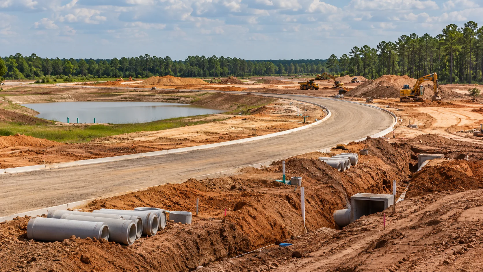
A Texas Department of Licensing and Regulation filing registered June 22, 2026 identifies Ascend at Longleaf at 12749 FM 1488. The filing lists S7 KTR LLC as the owner and describes new construction of a 7,642-square-foot amenity leasing office and clubhouse, with a listed start date of April 1, 2027 and a completion date of November 28, 2028.
That filing confirms that a multifamily component is part of the Longleaf picture. It does not indicate that the entire cleared tract is apartments. Montgomery Central Appraisal District records around the photo location show multiple S7 KTR parcels spread through the same survey abstracts that appear in the Longleaf plat records.
The safest way to understand the roadside view: the photographs are looking into the broader Longleaf development cluster, where subdivision sections and a multifamily component are being assembled in the same general area. The view from FM 1488 can take in more than one of those pieces at once.
The Road Work Did Not Start Because Longleaf Suddenly Appeared
It would be easy to look at new homes, bare land and road construction in the same corridor and assume one immediately caused the other. But a major FM 1488 widening project was already moving years earlier.
TxDOT's 2021 bid records describe a project from FM 1774 in Magnolia to west of FM 149 to widen the road and add lanes. A state project filing listed the work as reconstruction and widening from two lanes to four, with an estimated cost of about $48.7 million.
That does not answer every infrastructure question around Longleaf. It does tell us that the story is more complicated than "the houses came, then the road had to catch up." At least one major transportation project in this exact corridor predates the current Longleaf development by years.
What the Bare Land Is Really Showing Us
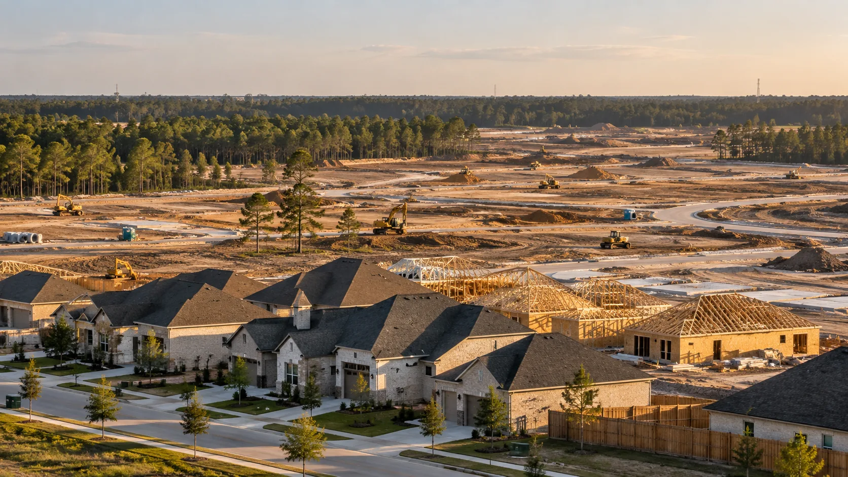
People usually notice development only after the trees disappear. By then, the important decisions can already be months or years old. Plats have been drawn. Engineers have reviewed drainage and roads. Land has changed hands. Utility questions have been raised. Developers have divided a large project into sections, lots and reserves.
Then the equipment arrives, the land changes almost overnight, and everyone driving past begins asking what happened.
That is what makes this stretch of FM 1488 worth following. The bare ground is not the beginning of the story. It is the moment the story finally became visible.
Next: Who Pays for the Growth?
Part 2 will follow the infrastructure and the money: roads, drainage, water, sewer, municipal utility districts, developer-funded work, public projects and the way all of those pieces can eventually show up on a property tax bill. Because the next question after "What are they building?" is the one longtime residents usually ask next: "Were we ready for it — and who is paying for it?"
Sources: City of Magnolia Planning & Zoning agenda packets, Jan. 23, 2025 and June 19, 2025; Newcor Commercial Real Estate announcement, May 2026; Realty News Report, May 30, 2026; Texas Department of Licensing and Regulation filing TABS2026023478 (Ascend at Longleaf); Montgomery Central Appraisal District parcel records; TxDOT bid tabulation, Project C 523-9-9, let Aug. 5, 2021; TDLR filing TABS2021019335.
Image note: Images in this package are illustrative editorial images generated for this story, except the reader locator (Image 2), which is a simplified graphic based on public records. None should be read as a survey, official site plan, or authenticated photograph of a specific parcel.