The ultimate Texas road trip is an eight-day loop to Big Bend
San Antonio, Fredericksburg, Enchanted Rock, two nights in Big Bend, and Marfa. The eight-day drive from the Houston area, with the days that are only for the car.
The ultimate Texas road trip is an eight-day loop of about 1,400 miles: San Antonio, Fredericksburg and Enchanted Rock, then a full driving day west to Marathon, two days in Big Bend National Park, a night in Marfa, and a split ride home on I-10. It starts from the Houston area, and it is the shortest route that still includes the two landscapes people mean when they say Texas — live-oak hills and a desert canyon on the Rio Grande.
Four days will get you the Hill Country. It will not get you Big Bend. The National Park Service says the park is too big for a single day, and the drive from the Austin area to Panther Junction is already 475 to 500 miles and eight or nine hours. This itinerary gives the desert two nights and does not pretend otherwise.
The route, in order
Leave the Houston area on I-10 west. Sleep in San Antonio, then Fredericksburg, then Marathon. Move to the west side of Big Bend for two nights in Terlingua or Study Butte. Sleep in Marfa. Break the trip home with a night in Junction or Kerrville so the last day is not a ten-hour stare at the interstate.
Day 1 — San Antonio. About 200 miles and three hours from Houston on I-10. See the Alamo while you are still glad to be out of the car. Walk the River Walk after dark, when the day-trippers have left. Do not push on to Fredericksburg tonight.
Day 2 — Fredericksburg and Enchanted Rock. About an hour and a half north. Enchanted Rock State Natural Area is 17 miles north of town on Ranch Road 965. Go there first, with a day pass already reserved on the Texas Parks and Wildlife site. The Summit Trail is short, steep, and exposed, and the park closes it when the granite is wet. The gate is open from 6:30 a.m. Trails close half an hour after sunset, except the Loop Trail.
Day 3 — The drive to Marathon. Take US-290 west to I-10 at Junction, stay on I-10 to Fort Stockton, then US-385 south. This is a fuel day, not a sightseeing day. Fill up in Fort Stockton. Cell service thins out after that. Sleep in Marathon. Do not plan to “arrive and see the park” after dark.
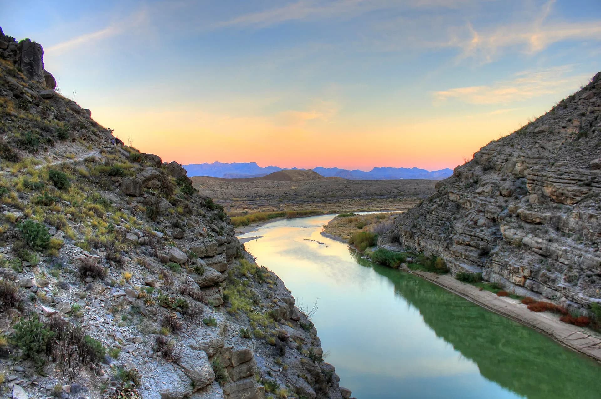
Day 4 — Santa Elena Canyon. The west entrance, at Study Butte, is the door to Ross Maxwell Scenic Drive. At the end of that road, the walk into Santa Elena Canyon is 1.4 miles round trip. The National Park Service calls it one of the park’s highlights and an easy hike. After rain, the Terlingua Creek crossing at the trailhead can stop you. Sleep in Terlingua or Study Butte.
Day 5 — The Chisos. Drive into the Chisos Basin. The park’s own three-day plan pairs the Ross Maxwell day with a longer hike here, including the Lost Mine Trail, about 5 miles round trip. Check that morning’s trail status before you count on it. Roads and trails close. Two nights is the minimum that matches the park’s own warning.
Day 6 — Marfa. Leave through Alpine and take US-90 west. The Marfa Lights viewing area is east of town on US-90, not on the square. Prada Marfa, the roadside installation, is west of town near Valentine. Sleep in Marfa. Eat before the kitchens close. West Texas does not keep Houston hours.
Day 7 — Junction or Kerrville. Point the car at I-10 east and stop while you are still willing to. Junction sits on the Llano River and is the natural break. Kerrville works if you want one more Hill Country evening.
Day 8 — Home. A humane half-day back to Houston. If a desert day ran long earlier in the week, this is the day you already budgeted. Use it. Do not invent a ninth adventure on the way in.
Why this order
West Texas is the point of the trip, and it sits at the far end of a long road. Doing San Antonio and Fredericksburg first means you arrive in the desert rested, with the city driving behind you. Turning around after Marfa, instead of looping south to Del Rio, puts you back on I-10, which is the road with the gas stations. US-90 through Del Rio is a fine alternate on the way out if you would rather see the border country than Junction. It is slower. It is not a shortcut.
From Austin, join the route at Fredericksburg and save San Antonio for the drive home. From San Antonio, you are already on Day 1. The shape of the trip does not change. The desert still takes a full day to reach, and it still deserves two nights.
San Antonio, without the checklist
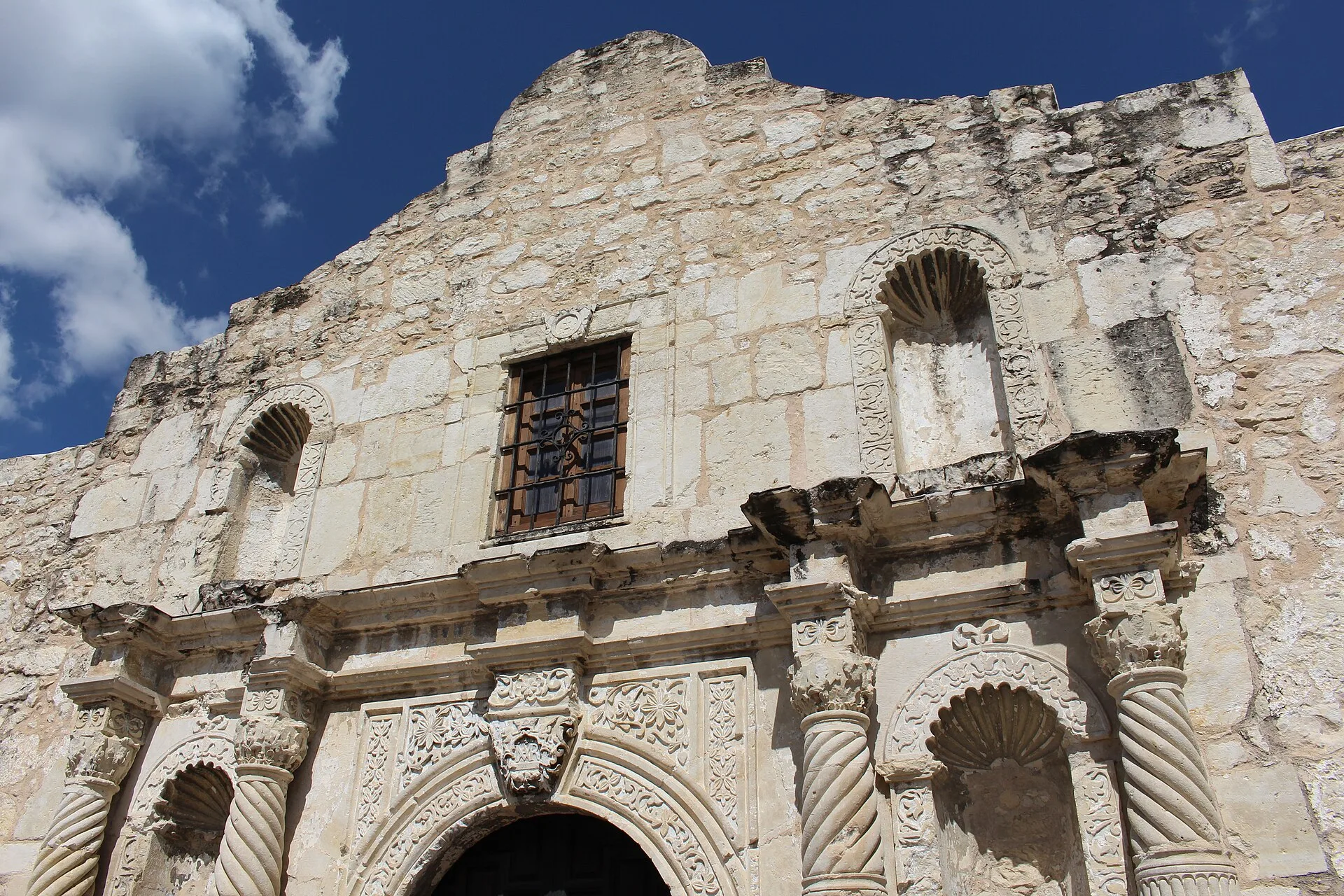
The Alamo’s facade in San Antonio. Photo: Abbie Myers, CC BY-SA 4.0, via Wikimedia Commons.
The Alamo is a small building in a loud plaza, and it is still the right first stop. Go when it opens. The plaza gets hot and the tour buses stack up late morning. You do not need a full day of missions unless that is the trip you wanted instead of this one. Mission San José is worth it if you have the afternoon and no interest in a mall.
Stay downtown or at Pearl, not on the north loop by the interstate. The River Walk is a ten-minute walk from the Alamo, and the version worth your evening is north of the tourist bend, toward Pearl, where people actually live. Eat there. Be back at the car by nine the next morning.
Fredericksburg and the rock
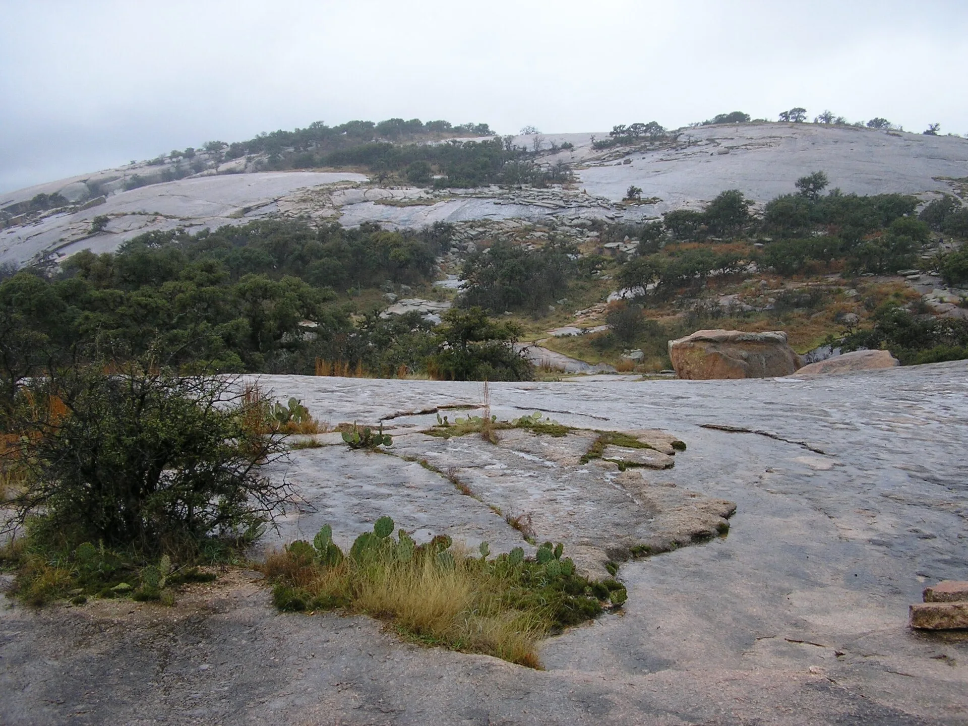
Enchanted Rock, 17 miles north of Fredericksburg. Photo: Another Believer, CC BY-SA 3.0, via Wikimedia Commons.
Enchanted Rock is a pink granite dome in the Llano Uplift, not a hill you stroll up in flip-flops. Texas Parks and Wildlife runs it as a state natural area at 16710 Ranch Road 965, Fredericksburg. Day-use entry is limited. Buy the pass before you leave San Antonio, and arrive inside your entry window. Weekend passes disappear.
Carry more water than feels reasonable. There is almost no shade on the summit. If the rock is wet, pick another trail instead of arguing with a closed gate. The park has nearly 21 miles of trail if the summit is shut. Afterward, Fredericksburg’s Main Street is the reward: a real town, German bakeries, and enough shops that you can lose the afternoon without a plan. If anyone is tasting wine, that person is not driving Ranch Road 965 back to the dome at dusk.
Big Bend, the part that makes the trip
Big Bend covers more than 800,000 acres. A one-day dash to the visitor center and back to the car is how people leave disappointed. The park’s suggested itinerary is blunt about it. One day can hold Ross Maxwell Scenic Drive and the Chisos Basin, and even that is a compromise. Three days lets you drive the major roads and still hike. This trip gives you two. That is the honest version of “ultimate” for a single week.
Start at a visitor center. Ask what is open. The Rio Grande, the Chisos Mountains, and the desert floor are three different parks that share a name, and they are an hour apart. Santa Elena Canyon is the photograph you came for: a limestone slot with the river in the bottom and Mexico on the far wall. The Chisos are the cool, oak-and-pine basin in the middle of the desert. Do not try to hike both at noon in July.
You do not need four-wheel drive for this itinerary. Ross Maxwell Scenic Drive is paved. The River Road, Old Ore Road, and the other unimproved tracks are a different trip. They want high clearance, current conditions from a ranger, and a spare day. Skip them unless that was the point.
Boquillas, the village across the river, is a border crossing, not a scenic pull-off. It requires a passport and an open port of entry. Check before you build a morning around it.
Gas up in Marathon, Alpine, or Study Butte before you sightsee. The park is not a place to discover an empty tank. Lodging inside the Chisos Basin and the campgrounds book far ahead. Terlingua and Study Butte exist so you can sleep near the west entrance without a park reservation. Book them before you book dinner in Fredericksburg.
Marfa, on the way out
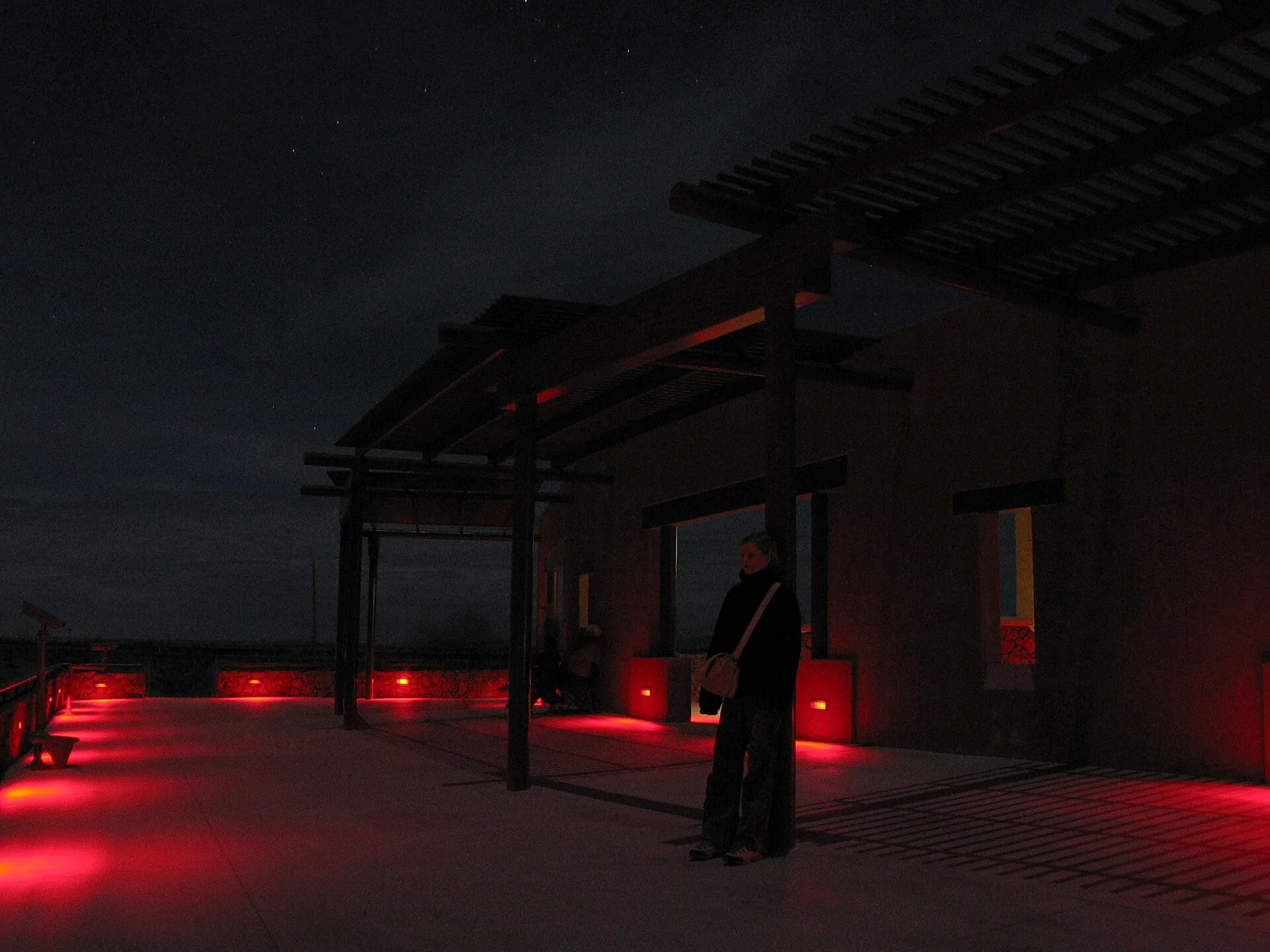
The Marfa Lights viewing area, east of town on US-90. Photo: Daniel Schwen, CC BY-SA 2.5, via Wikimedia Commons.
Marfa is an hour from the park and easy to mythologize into a lost weekend. Give it a night. Walk the town in the late light. If you want the lights, drive east of town to the viewing area on US-90 and stay a while. Most nights you will see headlights and a lot of stars. That is still worth it. The Prada installation is a separate stop west of town, on the way toward Valentine. It is a building-sized sculpture of a shoe store. It is not in downtown Marfa, and it is not open.
If you only have four days
Stay east. San Antonio for a night, Fredericksburg for two, Enchanted Rock on the morning you are freshest, and home. Add Luckenbach or a slow drive on the Willow City Loop only if you go early and use the pull-offs. Do not “swing by” Big Bend. The swing is an eight-hour drive each way.
When to go
October through April. Summer in the low desert is a safety problem, not a comfort problem. Spring break and wildflower season fill Fredericksburg and the state park. Big Bend’s busy weeks are the same cool months that make the hiking possible. Reserve Enchanted Rock and a Terlingua bed before you reserve anything else.
Pack for two climates in the same suitcase. The Hill Country can be cool and damp in the morning. The canyon is sun, wind, and a dry cold after sunset. A hat, a real water supply, and a paper map matter more than another pair of boots. Download offline maps in Fredericksburg, while you still have a signal you trust.
How many days do you need?
Eight days from the Houston area, with two of them mostly driving. Ten days is better if you want a third day inside Big Bend, which is what the National Park Service suggests for the major roads. Four days is a Hill Country trip. Anything sold as Big Bend and the Hill Country in a long weekend is a drive with the windows up.
What is the best route across Texas?
For one trip that covers the state people came to see: I-10 west to San Antonio, US-87 and US-290 to Fredericksburg, I-10 and US-385 to Marathon and Big Bend, US-90 to Marfa, I-10 east toward home. Fuel at Fort Stockton on the way in and again if you need it on the way out. That line hits the Alamo, the granite dome, the canyon, and the high desert without a useless extra state.
Sources
Distances and the shape of the drive follow Visit Big Bend’s Austin driving guide: about 475 to 500 miles and eight to nine hours from Austin to Panther Junction, with Fort Stockton as the fuel stop. The park days follow the National Park Service suggested itineraries, including the 1.4-mile Santa Elena Canyon walk and the warning that one day is not enough. Enchanted Rock’s location, hours, and trail rules are from Texas Parks and Wildlife. Check those pages the week you leave. Roads, trail closures, and day-pass rules change faster than a magazine does.