The History of Plantersville, Texas
Plantersville, Texas (ZIP 77363) was a settlement before it had a name. Mrs. J. L. Greene suggested the post office name in 1856, to honor the planters. The Handbook’s later counts do not match its own table.
Editor’s note. This is the sixteenth installment of “Texas Towns: The Stories Behind the Map.” Oak Ridge North, the last one, is a subdivision on Interstate 45. This one turns west, back to the highway the series already walked at Dobbin. The 1962 Geological Survey sheet that still prints Dobbin and Bobville is named for Plantersville. Plantersville is in Grimes County. Dobbin is in Montgomery County. They share a road and a map. They do not share a founding.
Plantersville, Texas, sits at the junction of State Highway 105, Farm Road 1774, and the Atchison, Topeka and Santa Fe Railway in southeast Grimes County. The mailing ZIP is 77363. The Handbook of Texas marks the place incorporated and still lists a post office. Its associated name for the town is St. Mary. [1]
A settlement before anyone named it
Americans, primarily from Alabama and Arkansas, settled the ground in the 1830s. The Handbook is careful about what that means. It says no actual community seems to have existed until about 1840. The settlement that did emerge sat near the junction of the headright grants of Austin colonists Asa Yeamans, John Landrum, and William Montgomery. [1]
In 1843 an Alabaman, Isaac Baker, began a plantation of 2,850 acres called the Cedars, three miles northeast of that settlement. The acreage is large enough that later tellings fold the plantation into the town. The Handbook keeps them apart. The Cedars was three miles off the place that was becoming a community. It had its own name. Plantersville was not yet a word anyone had put on a post office. [1]
By the early 1850s the community had a two-story Masonic building, with a school on the lower floor. In 1853 the Rev. Robert Alexander organized a Methodist congregation of some 200 members, including many slaves. In 1861 a Baptist group formed with twenty members. George W. Baines, whom the Handbook identifies as the great-grandfather of President Lyndon Baines Johnson, served as its first pastor. The two congregations shared the Masonic building until each could build. The Baptists did that in 1871. The Methodists did it in 1873. [1]
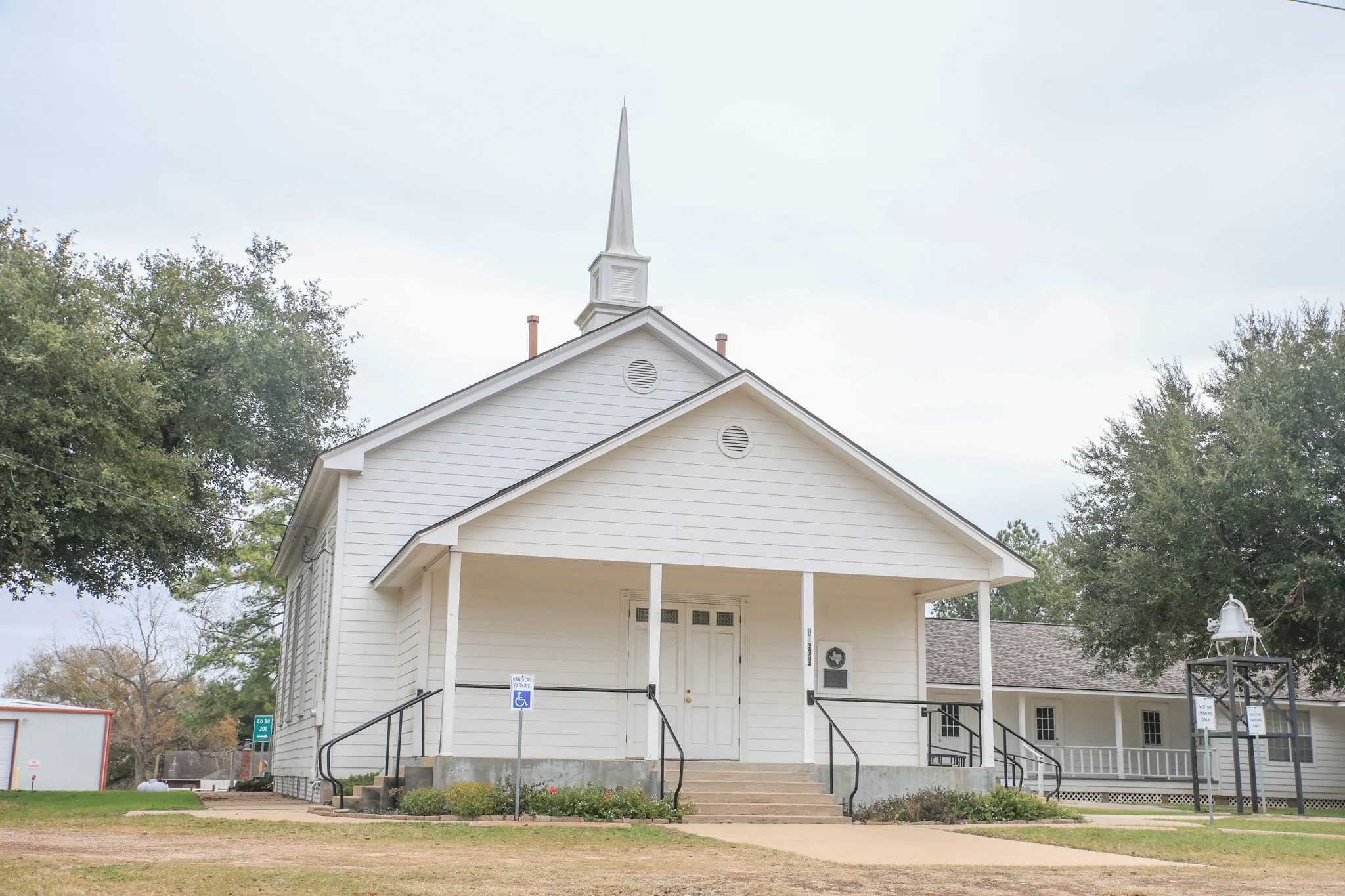
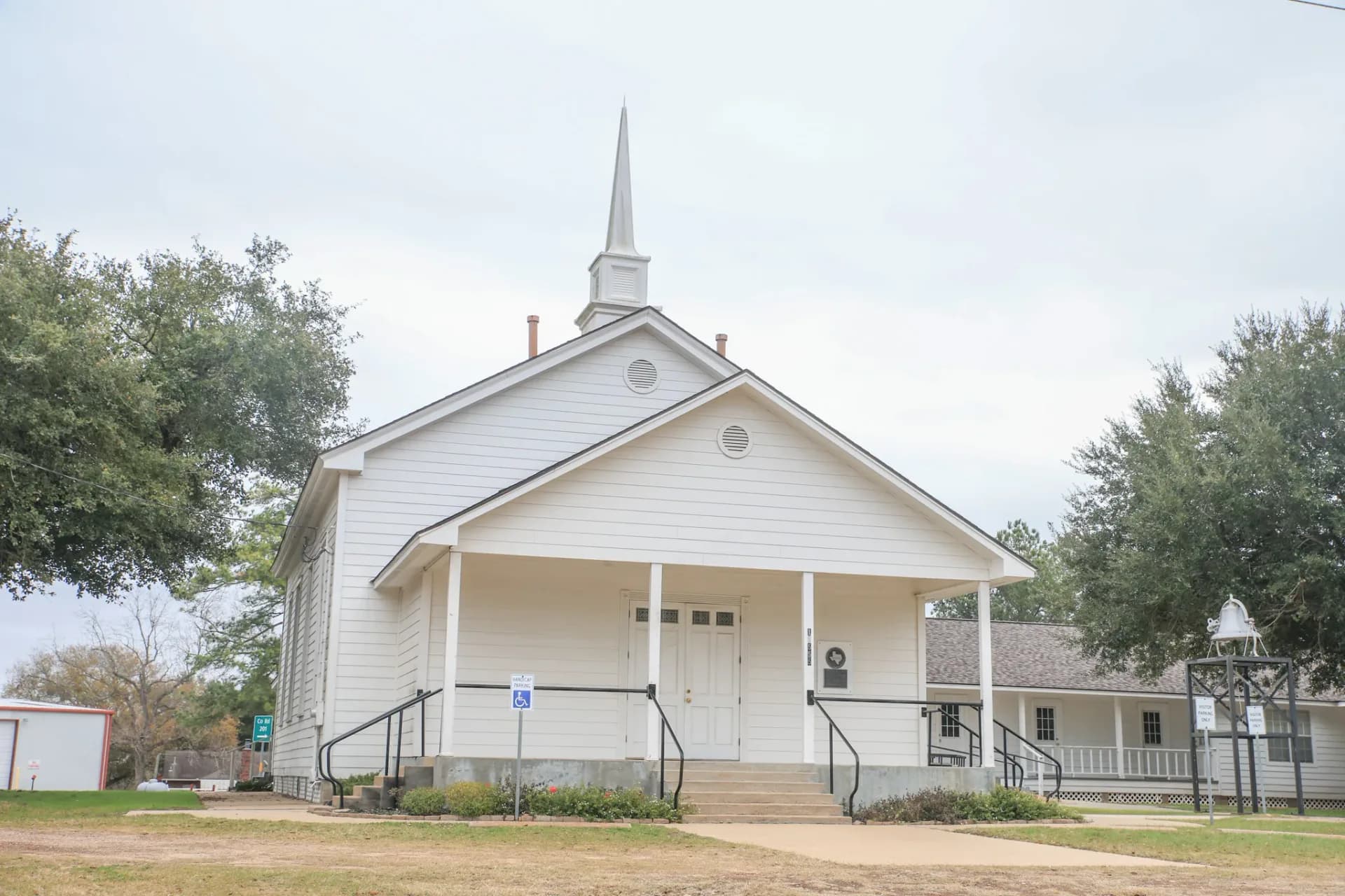
Plantersville Baptist Church. A Baptist congregation was organized here in 1861, and the Handbook says it built its own church in 1871. This photograph shows the building standing now. Renegomezphotography, CC BY-SA 4.0, via Wikimedia Commons.
The first general store, Isaac Baker and Sons, opened in a two-story frame building sometime between 1854 and 1860. The Handbook gives the range and does not pick a year inside it. A store that opened “sometime between” two dates is not a store that opened in 1854, and it is not a store that opened in 1860. [1]
1856: a name suggested for the planters
A post office was established in 1856. The town was officially designated Plantersville, a name suggested by Mrs. J. L. Greene, to honor the planters who had settled the site. The Handbook does not give her a first name. It does not say she owned the Cedars, or that she named a city that had just been founded. The settlement had been taking shape since about 1840. The post office gave it a word. The word was a compliment to people already there. [1]
After the war, the rolls
Following the Civil War, Plantersville Methodists, led by Thomas W. Blake and the Rev. J. M. Wesson, launched a ministry among local freedmen. In 1866 their church reported a membership of 143 Whites and 172 Blacks. Those are the Handbook’s figures, and the Black membership is the larger number. [1]
The Baptists undertook a similar ministry among Black members both during and after the war. The Handbook says the experiment was terminated in 1870, when Black members were dropped from the rolls. It does not describe a peaceful separate founding, and it does not give the dropped members a new church in the same sentence. The record it prints is a removal from the rolls. [1]
The railroad, then St. Mary’s
Commercial activity increased in 1879, when the Montgomery Central Railway built a line through, connecting Montgomery and Plantersville with Navasota. A few years later the Gulf, Colorado and Santa Fe bought that road and extended it east to Conroe and Beaumont and west to Somerville. That is the railroad family the 1962 map still draws across the northern part of the Plantersville quadrangle, and it is the same Santa Fe the Dobbin story is about, a few miles east in Montgomery County. Dobbin’s post office moved to a crossing on that line in 1909. Plantersville was already a named town by then, with a post office older than the track. [1]
An influx of immigrants from Russia, Poland, and Germany in the 1870s and 1880s brought Catholics to the vicinity. By 1894 Father Joseph I. Klein had organized the first Catholic church in the community, St. Mary’s. The Handbook’s associated name for Plantersville is St. Mary. That name belongs to the church, not to a second town with its own post office. [1]
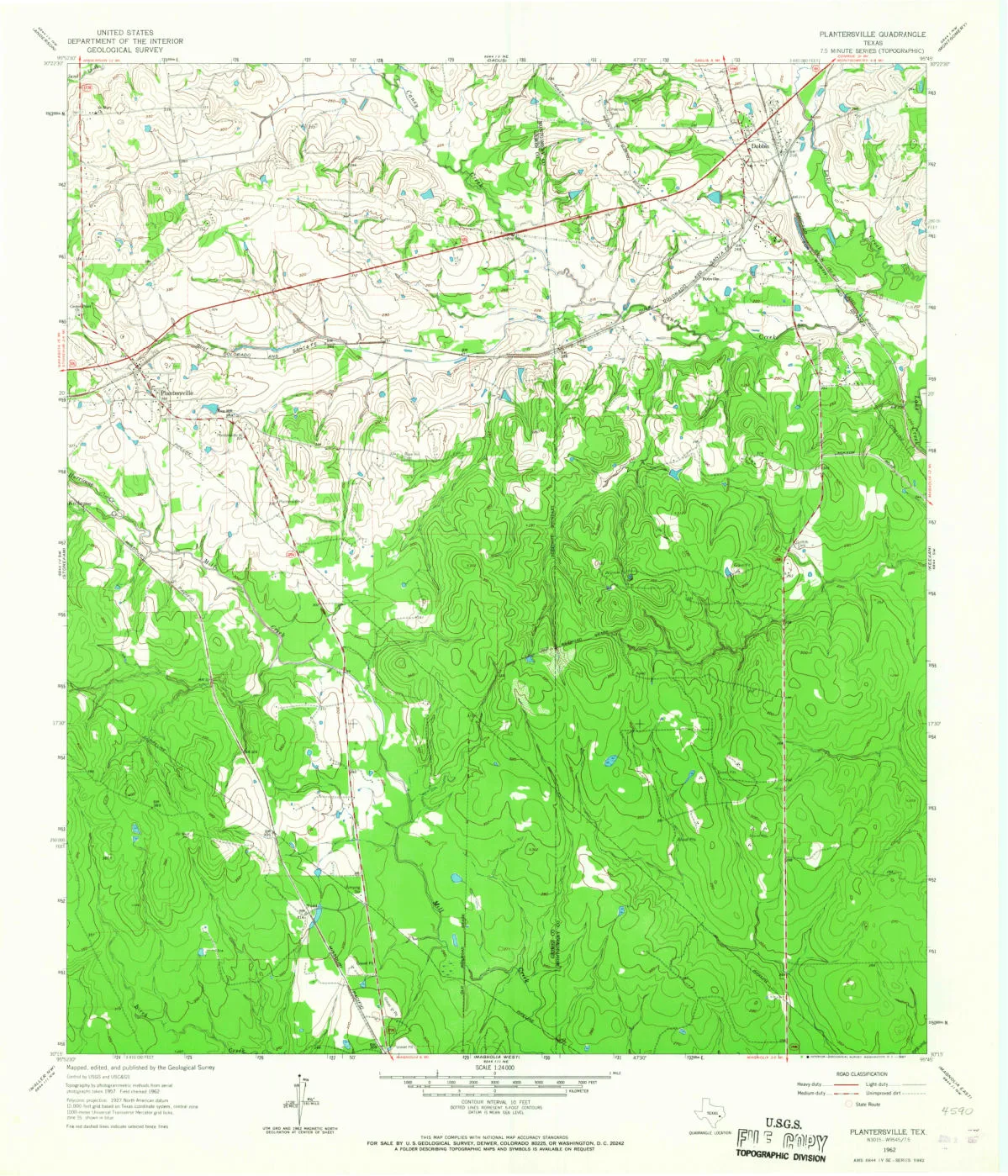
The 1962 Plantersville quadrangle. State Highway 105 and the railroad run through the northern part of the sheet, which is where the town name sits. South of that junction the map is mostly woods and contour lines. U.S. Geological Survey. Public domain.
Two population stories on one page
In 1890 Plantersville reported a population of 400. In 1915 the town had general stores, gristmills, cotton gins, a wagon-manufacturing plant, and a population of 150. By 1936 the estimate was 200, with four businesses, including the Security State Bank. In 1957 the estimate was still 200, with five businesses. In 1990 it stood at an estimated 212, with ten businesses. In 2000 the population remained 212, and the business count was forty-seven. [1]
The narrative says that after 1936 the population remained virtually unchanged for decades. From an estimated 200 to an estimated 212, that sentence is fair to the prose. It is not fair to the table printed on the same Handbook entry, which the narrative does not discuss: 260 people in 2009, 464 in 2020, and 473 in 2021. [1]
We print both. We do not average 212 and 464, and we do not invent a cause for the difference. A business count can move while a population estimate sits still. The 2000 sentence already says that: the same 212 people, and forty-seven businesses where there had been ten. A census count and a local estimate are also different instruments. The Handbook page gives a reader both sets and does not say which boundary, or which method, produced the later table. Anyone who needs a single current population will not get it from this entry. [1]
What the 1962 sheet still shows
The Plantersville quadrangle is a 1:24,000 sheet surveyed and published by the U.S. Geological Survey. Highway 105 and the railroad cross the northern edge of the map. The town name is at that junction. The woods south of it are the larger part of the sheet. The Cedars, three miles northeast of the old settlement, is not a label this article is going to pretend sits in the middle of the page. [2]
The same sheet is the one that still prints Dobbin at a railroad crossing and Bobville on the Santa Fe, about a mile apart, on the Montgomery County side of the line. That is a different town, with a different ZIP. Dobbin’s mailing code is 77333. Plantersville’s is 77363. Sharing a quadrangle name is how the survey named the paper. It is not how the post office named the towns. [2]
The complete story of Plantersville
Plantersville is a settlement that stood near three Austin colony headrights, a Masonic schoolroom, two churches that shared a hall, and a store belonging to Isaac Baker and Sons. In 1856 Mrs. J. L. Greene suggested the post office be named for the planters. The Cedars, 2,850 acres, was three miles northeast and already had a name of its own.
The railroad arrived in 1879, two decades after the post office. St. Mary’s arrived in 1894. The Handbook’s later page then tells two population stories at once: a narrative that holds the estimate at 212, and a table that lists 464 in 2020. Both are on the entry. Only one of them can be a reader’s answer if the reader insists on one number. The entry itself does not insist.
Questions people ask
Who named Plantersville? The Handbook says Mrs. J. L. Greene suggested the name in 1856, when the post office was established, to honor the planters who had settled the site. It does not give her a first name, and it does not treat 1856 as the year the ground was first occupied. Settlement was in the 1830s. A community, by the Handbook’s account, dates from about 1840. [1]
Is Plantersville the same place as Dobbin? No. Dobbin is an unincorporated community in western Montgomery County, ZIP 77333, on State Highway 105. Plantersville is in southeast Grimes County, ZIP 77363, at Highway 105 and Farm Road 1774. The 1962 Geological Survey sheet that shows both is titled Plantersville. The towns are different places. [1]
Was Lyndon Johnson’s family from Plantersville? The Handbook says George W. Baines, great-grandfather of President Lyndon Baines Johnson, was the first pastor of the Baptist group formed here in 1861, a congregation of twenty members. It does not say the president was from Plantersville, and it does not place the Baines household on the Cedars. [1]
Why do the population numbers disagree? The narrative holds an estimate of 212 in both 1990 and 2000. A table on the same entry lists 260 in 2009, 464 in 2020, and 473 in 2021. This article prints both and does not average them. [1]
Sources
Charles Christopher Jackson, “Plantersville, TX,” Handbook of Texas Online, Texas State Historical Association, revised September 24, 2020. tshaonline.org/handbook/entries/plantersville-tx. The entry’s bibliography is the Grimes County Historical Commission, History of Grimes County, Land of Heritage and Progress (Dallas: Taylor, 1982), and Fred I. Massengill, Texas Towns (Terrell, Texas, 1936).
U.S. Geological Survey, Plantersville quadrangle, Texas, 1:24,000, 1962. Public domain. TX_Plantersville_116270_1962_24000_geo.pdf.