Texas Towns: The Stories Behind the Map
The History of Dobbin, Texas
Bobbin was not simply renamed. The post office moved a mile.
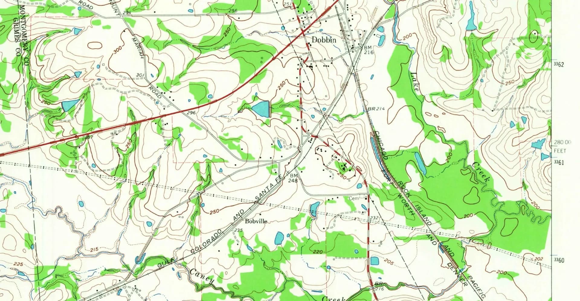
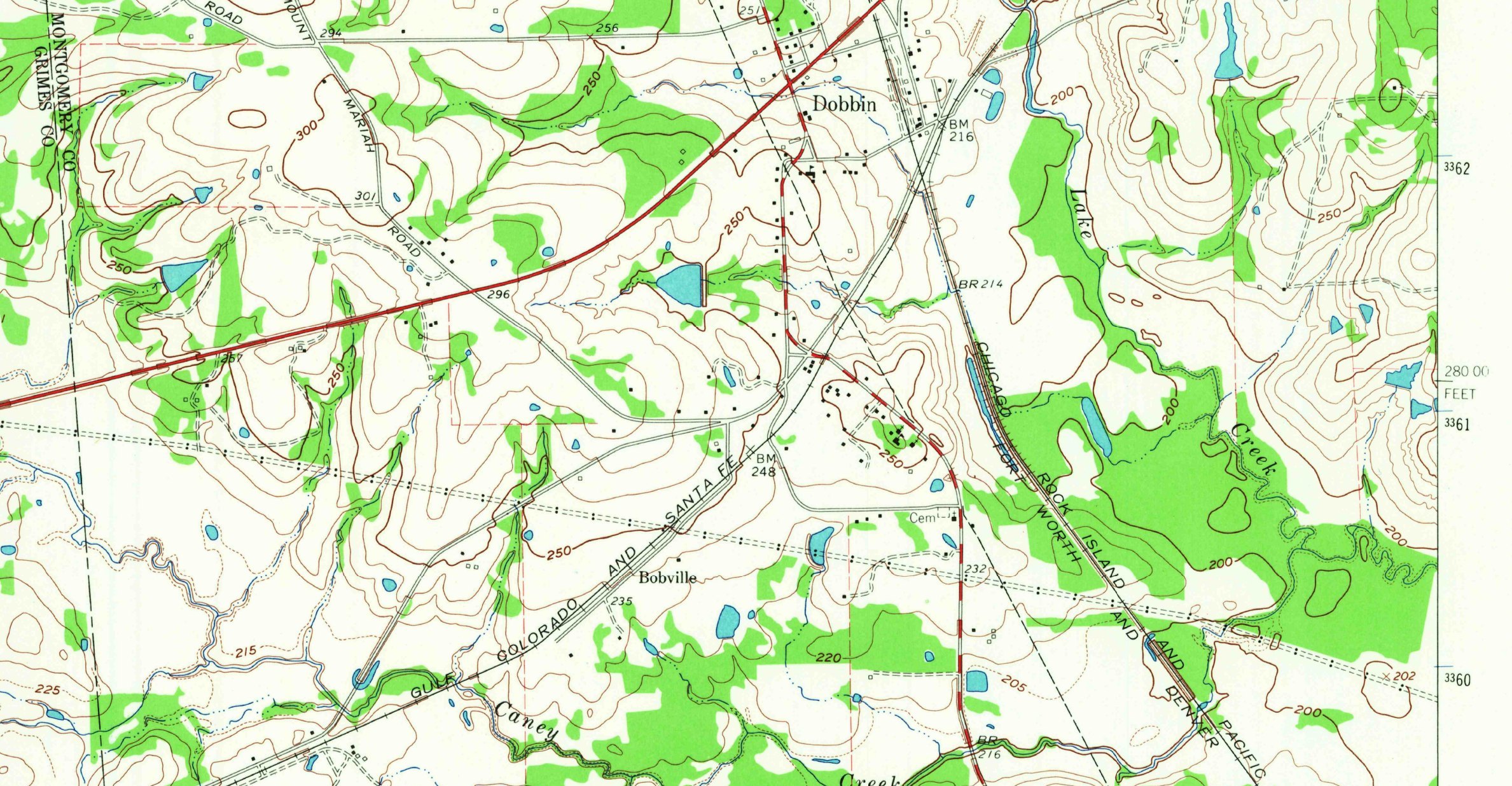
The 1962 Plantersville quadrangle still prints both names. Dobbin sits at the crossing. Bobville sits on the Gulf, Colorado and Santa Fe, about a mile down the track. U.S. Geological Survey. Public domain. — U.S. Geological Survey, Plantersville quadrangle, 1962. Public domain.
Dobbin, Texas (ZIP 77333) began as a post office called Bobbin in 1880, on the Central and Montgomery Railway in western Montgomery County. In 1909 the name changed because the office had moved to a new railroad crossing about a mile away. A 1962 map still prints both Dobbin and Bobville.
- ZIP
- 77333
- Post office
- 1880, as Bobbin
- Renamed
- 1909, at the new crossing
- Incorporated
- No
Editor’s note. This is the twelfth installment of “Texas Towns: The Stories Behind the Map.” Cleveland was the railroad’s town on the east side of the woods. Dobbin is the junction on the west side of Montgomery County. The Handbook says Bobbin was renamed Dobbin in 1909. The post office papers say the office moved about a mile, to a crossing the second railroad had just built. Both labels were still on the map in 1962.
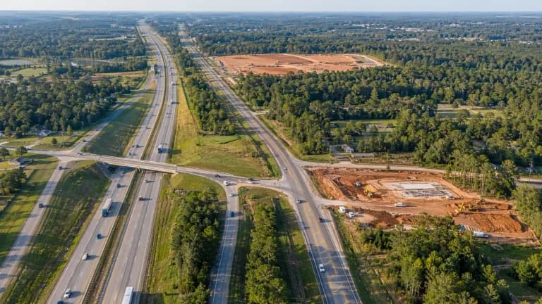
Dobbin, Texas, is an unincorporated community on Lake Creek in western Montgomery County, near the intersection of State Highway 105 and Farm Road 1486. The mailing ZIP is 77333. It was never a city. It was a post office that followed a railroad diamond. [1]
A camp, then a grant, then a long gap
The Handbook’s earliest date is not a founding. René-Robert Cavelier, Sieur de La Salle, camped northwest of the later site on February 14, 1687. Two centuries later, Noah and Ester Wightman Griffith, from New York, received a Mexican land grant here in 1831. The Handbook spells her name Ester. Neither the camp nor the grant is a town called Dobbin. [1]
1880: the post office called Bobbin
In 1878 the Central and Montgomery Railway built through from Navasota to Montgomery. A post office opened in 1880 under the name Bobbin. By 1885 Bobbin was a shipping point for cotton and lumber, with daily mail, four sawmills, a gristmill, a flour mill, a church, a district school, two general stores, a physician, and 100 people. [1]
The 1890s list is a working hamlet: a Baptist church, a cotton gin, W. G. Post’s sawmill, J. M. Stinson’s general store, two livestock dealers, a combination mill and gin, a blacksmith, and a population of 250. In 1903–04 the town had three one-teacher schools. One had thirty-seven white students, one had eighteen white students, and one had forty-three Black students. The population had fallen to 168. [1]
The second railroad stopped a mile from the first depot
The Handbook says that in 1906 or 1907 the Trinity and Brazos Valley Railway built through Bobbin on the way from Mexia to Houston and made the town a junction, and that in 1909 the name changed to Dobbin. That sentence is the short version. [1]
The crossing record is more exact. In the summer of 1906 the Trinity and Brazos Valley crossed the Santa Fe — the old Central and Montgomery, by then part of the Gulf, Colorado and Santa Fe — about a mile northeast of the Bobbin community. Santa Fe already had a depot at Bobbin. The new railroad opened a depot at the diamond and, for a while, called that Bobbin too. Two depots, one name, a mile of dirt between them. [2]
The Railroad Commission ordered the crossing protected. Tower 70, a twelve-function mechanical interlocker, began work on April 25, 1907. [2]
On November 23, 1908, the Post Office Department asked the Bobbin postmaster about a new location. The reply put the proposed site 1,500 yards to the northeast, just under a mile. By the end of 1908 the postmaster was ready to move the office to the crossing, which had outgrown the older stop. On November 2, 1909, Washington addressed the next form to “Dobbin (Late Bobbin).” The postmaster answered that the office stood in the “center part of new township,” 132 feet from the Santa Fe track and 400 feet south of the Trinity and Brazos Valley depot. The name change is the post office moving house. [2]
People at the old stop did not all follow. In 1911 they asked for a replacement post office under the name Bobville. A 1915 Post Office form is addressed to the postmaster at Bobville. In December 1910 the Railroad Commission dismissed a complaint from Dobbin residents who wanted one union passenger station. On May 19, 1916, it ordered the Santa Fe to stop at the crossing. Santa Fe finished a depot there on June 10, 1916. It may have been little more than a platform and a boxcar shelter. [2]
The name the Palestine paper gave away
A one-sentence item in the Palestine Daily Herald of April 6, 1909, said the community was named for Garrett Dobbin, a Santa Fe colonization agent whose Texas promotion was news in those years. Palestine is a hundred miles away. The historian who found the item could not find a matching story in the Conroe, Montgomery, or Navasota papers, or in Teague, where the Trinity and Brazos Valley had its shops. The Handbook does not use the story. We print it because people will repeat it. We do not treat a single wire-service sentence as a christening. [2] [1]
What the record will support is smaller and better. Bobbin was the 1880 post office on the Santa Fe. Dobbin was the name that office carried after it moved to the new crossing in 1909. Bobville was the name the people who stayed behind used for the old stop. The 1962 map still had room for both. [2] [3]
After the diamond
The Handbook’s later inventory is modest, and it is all one place again. In 1915 the population was 100, with three general stores, two blacksmith shops, a drugstore, and a grocery. Dobbin School was established in 1926. By the late 1940s there were three churches, two schools, two sawmills, two factories, nine businesses, the railroad station, and about 175 people. A post-peeling plant was operating in 1965. The count was 106 in the late 1960s and 170 in the early 1970s. [1]
In 2000 the Handbook still estimated 170 people, and named seven businesses, including Mock’s Feed Store and Grocery and Hoffart’s Store, plus a post office, the Dobbin station of the Montgomery Fire Department, and two churches. A separate count on the same entry says 310 in 2009. We print both. We do not average them. [1]
The complete story of Dobbin
Dobbin is not a French camp, and it is not a banker’s name from a Palestine filler item.
It is a cotton and lumber post office called Bobbin, and then a mile-long argument between two depots about which stop got the mail, the passengers, and the name.
The Geological Survey settled it the way surveyors do. In 1962 it labeled both.
Quick answers
Dobbin history FAQ
Was Dobbin named for Garrett Dobbin?
The Handbook of Texas does not say so. It says a post office called Bobbin opened in 1880 and the name became Dobbin in 1909. A one-sentence item in the Palestine Daily Herald of April 6, 1909, credited Santa Fe colonization agent Garrett Dobbin. No Conroe, Montgomery, or Navasota paper has been found to back that up. We do not treat it as fact.
Did La Salle found Dobbin?
No. The Handbook says René-Robert Cavelier, Sieur de La Salle, camped northwest of the later townsite on February 14, 1687. The first family it names on the ground is Noah and Ester Wightman Griffith, who received a Mexican land grant in 1831. The post office is 1880.
Is Dobbin an incorporated city?
No. Dobbin is an unincorporated community in western Montgomery County, near State Highway 105 and Farm Road 1486. ZIP 77333 is the mailing code. The Handbook still records a post office.
Sources
Notes and credits
- [1]Texas State Historical Association, “Dobbin, TX”
- [2]Texas Interlocking Towers, “Tower 70 — Dobbin” (Railroad Commission orders and National Archives post office papers)
- [3]U.S. Geological Survey, Plantersville quadrangle, 1:24,000, 1962
Numbered citations in the story are live links. Source language is paraphrased except where quotation marks identify a short title or documented phrase.