The History of Roma, Texas
Roma, Texas (ZIP 78584) began as ranch land of Mier, granted in 1767 under José de Escandón, and became the head of steamboat travel on the Rio Grande. The Handbook says it was renamed Roma in 1848; a federal landmark study says Stephen F. Austin already called it Roma in 1823.
Editor’s note. This is the twenty-eighth installment of “Texas Towns: The Stories Behind the Map.” The last one went to Albany, on the Rolling Plains, a county seat that outlasted the army post beside it. This one goes about as far south as the series has been, to the Rio Grande. Our Goliad installment told how Spain planted a presidio and missions on the San Antonio River. Roma comes out of a different Spanish project of the same years: José de Escandón’s colony of Nuevo Santander, which the National Park Service says was set apart by its focus on civil settlement. The Park Service calls Roma the only intact settlement in the United States that grew out of it.
Roma, Texas, sits on sandstone bluffs above the Rio Grande in southwestern Starr County, directly across the river from Ciudad Miguel Alemán, Tamaulipas. Roma is a port of entry on U.S. Highway 83, the border highway that the state’s 1932 designation ran from Laredo through Zapata and Roma toward San Juan and Brownsville. It is not the county seat; that is Rio Grande City, downriver. The Handbook of Texas records that the railroad reached Rio Grande City in 1925 and that new roads were built on to Roma; it does not record a railroad reaching Roma itself. Roma and the adjoining settlement of Los Saenz are incorporated together as Roma-Los Saenz. The mailing ZIP is 78584. [1] [2] [24] [3]
The 2020 census counted 11,561 people. The Census Bureau’s estimate for July 1, 2025, is 11,543. The Handbook says Spanish is the primary language. A visitor today sees a plaza that opens toward Mexico, a church tower at its head, and two-story brick buildings with iron balconies, built in traditions the Park Service traces to Northern Mexico. The National Park Service designated the old town a National Historic Landmark district in 1993. Much of what follows comes from that nomination, from the Handbook, and from the state’s markers. Some of it is violent. This article tells it the way those sources do. [1] [23] [3]
Before 1753: salt, a ford and the Pass of the Mules
People lived along this part of the river long before any Spaniard saw it. The Handbook’s county entry says the evidence goes back about 11,000 years, to hunter-gatherers of the Archaic Period and later peoples who began experimenting with farming. Neither the Handbook nor the landmark nomination names the native groups who lived at the Roma bluffs when the Spanish arrived. The nomination notes that archaeological sites tied to Indian encampments and trade-route activity may exist inside the historic district but have never been investigated. [2] [3]
Spanish travelers passed through in the 1600s. In August 1638 Jacinto García de Sepulveda crossed into the area at Mier looking for Dutch sailors reported on the Texas coast, and Alonso De León’s second expedition followed the river in 1687. In 1747 Miguel de la Garza Falcón looked over the north bank and condemned it as unfit for ranching or farming. The crown sent José de Escandón anyway. [2]
The landmark nomination describes what the country looked like to Escandón’s survey parties. There were dry salt lakes a short way north of the bluffs, and his men, who paid their own way, were eager to pack salt back to Monterrey. The bluffs were framed by two arroyos, the Arroyo de los Negros on the west and the Arroyo Roma on the east. Across the river a large arroyo, the Arroyo de San Pedro, ran back toward the San Juan River. It made a more direct crossing to the salt beds than the older ford upstream, and the survey of 1747 named the crossing El Paso de la Mula, the Pass of the Mules. The nomination says Escandón’s work parties were led to the junction of the San Juan and the Rio Grande by an Indian chieftain. It does not give his name or his people. [3]
Escandón was a soldier before he was a colonizer. The Handbook says he put down an Indian uprising in Celaya in 1727 and was promoted in 1740 for “pacifying the Indians.” The state’s 2013 marker on the Nuevo Santander land grants says he “organized an expedition and conquered the area.” A 1936 marker west of Roma says a visita, an outlying mission, was established near there in 1750 “to settle the region and civilize and Christianize the Indians.” Those are the words of the markers, and they say plainly what the colony meant for the people already here. The sources do not record what became of them. [4] [13] [12]
The sources also disagree on the size of the project. The Handbook says Escandón founded “over twenty towns or villas and a number of missions.” The state marker says twenty towns and eighteen missions between 1749 and 1755. The landmark nomination counts twenty-three towns and fifteen missions between 1747 and 1755. We print all three. [4] [13] [3]
1753–1821: ranch land of Mier
Roma began as the far side of another town. On March 6, 1753, Escandón founded Mier, on the Alamo River a few miles from the Rio Grande in what is now Tamaulipas. The nomination says Mier was chartered as a lugar, a “place,” the only one of its kind among Escandón’s settlements, and was founded without government money by settlers already living at Camargo and at the El Cántaro ford. It looked more like a ranch than a town. [4] [3]
For years the colonists held land in common. In 1767 a royal commission came to survey the Rio Grande villas and give each settler a town lot and a porción, a long, narrow strip running back from the river. The state marker says the corners were set with mojoneras, pointed sandstone markers cut with the porción number, the year and the surveyor’s initials. North of the river the porciones became ranch land, mostly for cattle. The ground where Roma stands fell within porciones 71 and 72, which the Handbook says were issued to Juan Salinas and Juan Ángel Saens. [3] [13] [2]
When the first families moved across is not settled. The Handbook’s town entry says Corrales de Saenz was founded in the mid-1760s by the ranchers Miguel, Gerónimo and Juan Ángel Saenz, followers of Escandón from Mier. Its county entry says Corrales de los Saenz was founded about 1763 by the Saenz family. The landmark nomination says it was the next generation of the Salinas and Saenz families who occupied the two porciones, by about 1770. It adds that the Rancho de los Saenz existed only briefly, and that a second settlement just west of it, the Rancho de Buena Vista, took hold, with farming around it to supplement the cattle. Mier families also settled the river island just east of town, Los Morteritos, mostly occupied by the García family. The nomination suggests that family may be the source of another old name for Roma, “Garcias.” [1] [2] [3]
1821–1848: Buena Vista becomes Roma
The record for the 1820s is thin, and the nomination says so: “little is known with certainty.” Some sources give 1821, the year of Mexican independence, as the founding date of Roma. The Handbook says the place was known first as Buena Vista and then as Garcia Ranch, and that the name Roma came in 1848, when the area became part of the United States, on the suggestion of the Oblates of Mary Immaculate. The nomination complicates that. It says Stephen F. Austin, in an 1823 letter to an associate, drew a map that labeled Roma with its farm and ranch lands. The two accounts cannot both be right about when the name was first used. The Handbook also places the Oblates’ mission at Roma in the mid-1850s, several years after the renaming it credits to them. [3] [1]
Austin did not settle here; he took his colony to San Felipe in 1824. In 1829 his cousin Henry Austin brought the steamboat Ariel to the Rio Grande and mapped the river as far as Camargo. The nomination says his map shows buildings on the Roma bluffs. Through the 1830s the river trade ran on shallow keelboats, and northern Tamaulipas was torn by rebellion against the central government, with the old Escandón towns at the center of the fighting. [3]
Roma’s church history begins with a chapel the townspeople built themselves. A 1973 state marker on Estrella Street says the first chapel in Roma was built by volunteer labor, on a donated site, from contributed materials, about 1840. Before the Oblate Fathers came, the marker says, some 500 people had received the sacraments there from priests who lived in Mier. [15]
In December 1842 the Republic of Texas reached the river here. The Mier expedition broke away from the Somervell expedition and moved down the Rio Grande looking for Mexican settlements to raid for cattle and horses. A 1936 state marker on U.S. 83 at Roma says the Texans camped there on December 21, 1842. The Handbook says they reached a point on the east bank opposite Mier on December 22. On December 23 most of them crossed and requisitioned supplies from Mier; on Christmas Day 261 Texans crossed again and fought Mexican troops under Gen. Pedro de Ampudia until the afternoon of December 26. The Handbook gives Mexican losses as 600 killed and 200 wounded against thirty Texans killed and wounded, and says the Texans surrendered after a white-flag demand. After a mass escape at Salado in February 1843, the recaptured men drew beans. Seventeen who drew black beans were blindfolded and shot. The last survivors were released in September 1844. [5] [14]
The river country stayed in dispute. The nomination says that as late as 1839 the Texas Congress still understood the salt beds north of Roma to lie within Tamaulipas. Only with the end of the Mexican War in 1848 did Roma officially become United States soil. The Handbook says it had the only post office in Starr County that year. [3] [1]
1848–1886: head of navigation
For the next forty years Roma lived on the river. The Handbook says that from 1850 to 1900 it was the westernmost port on the Rio Grande for the flatboats and steamers carrying cotton downstream. The nomination says steamboats docked at Roma from about 1829 into the 1880s and calls the steamboat years 1846 to 1886. It describes Roma as the head of steamboat travel and a distribution point for goods headed into the interior of Mexico. Early in the 1850s, gold seekers bound for California came up the river and crossed into Mexico at Roma to go overland to the West Coast. [1] [3]
The Oblates of Mary Immaculate, a French missionary order, made Roma their second Texas headquarters. The Handbook’s order entry dates the Roma center to 1854 and calls Roma the farthest point reached by commercial riverboats. Father Pierre Yves Kéralum, a carpenter and architect from Brittany before he was a priest, was assigned there in mid-1854 and designed the parish church; the Handbook says its cornerstone was laid in September 1854. The landmark nomination and the First Chapel marker date the Oblates’ arrival and the church to 1853. Kéralum rode a circuit of seventy to 120 ranches, preaching, baptizing and marrying people; the Mexican families he served called him el Santo Padre Pedrito. He disappeared on a missionary trip in November 1872, and cowhands found his remains a decade later. The Handbook says foul play was suspected. It does not say anything was proved. [6] [7] [3] [15]
American merchants, lawyers and politicians followed the new border. The nomination says they married into the old Escandón families and typically came to control life in new river towns such as Brownsville, and that by setting up new communities and enlarging old ones like Roma, the Americans captured the trade. Mexico’s tariffs made goods dearer on its side of the river, and trade and smuggling ran north. In 1858 Tamaulipas answered with a free-trade zone along its northern border. By the late 1850s, the nomination says, the raids of Juan Nepomuceno Cortina ran from the Gulf to Roma, in a conflict over land and over newcomers’ control of the economy. [3]
The Civil War made Roma rich and dangerous. With the Union blockading the coast, Confederate cotton moved overland and down the Rio Grande to Matamoros and the Gulf, and the nomination says Roma’s merchants grew wealthy on it. Noah Cox, an American merchant who had married into the García family, organized a pro-Confederate guard at Roma. In December 1862 the Union-backed guerrilla leader Octaviano Zapata crossed the river at Roma and attacked a Confederate supply train. The Noah Cox House on the plaza is a Recorded Texas Historic Landmark. After the war, the nomination says, a hurricane wrecked the river’s steamboat facilities at Brownsville in 1867, “Indian raids and robberies were commonplace,” and Roma was still a modest place. [3] [28]
Smuggling became a way of life in both directions. By the mid-1870s Mexican merchants in the free zone were underselling American goods in Texas, and the nomination says Roma grew as a contraband center in the 1870s and 1880s. In 1884 American politicians from Roma moved onto Los Morteritos, the island that Manuel Garza Peña of Mexico farmed as its understood owner, and accused him of packing contraband into Texas. The nomination calls it an invasion. The island was eventually declared United States territory, and the dispute led to a boundary treaty in 1886 and to the International Boundary Commission in 1889. Morteritos’ families, descendants of Escandón’s colonists, went on living there. [3]
The railroads finished the river trade. Lines reached Laredo in the late 1870s and early 1880s and bypassed the steamboat ports of Roma, Rio Grande City and Camargo. At the same time, irrigation upstream was drawing the river down. The nomination says the Rio Grande at Roma was thirteen inches lower in 1859 than in 1850, about two feet lower by 1869, nearly four by 1879 and more than seven by 1900. Trade swung back to the old north-south route across the river at the San Pedro ford. [3]
1877–1894: Portscheller’s brick
Roma’s best-known buildings went up in the years the steamboats were fading. Heinrich Portscheller came to the border from Germany by way of war. The Handbook says he landed at Veracruz in 1865, was pressed into Emperor Maximilian’s army, deserted to Texas by June 1866, and, encouraged by agents of the Mexican general Mariano Escobedo, fought in the battle of Santa Gertrudis near Camargo, and then worked as a mason at Fort Ringgold and around Rio Grande City, Roma and Mier. He married Leonarda Campos in 1879, and after two years in Mier moved his family to Roma, where he set up a brickyard and a building crew. The Handbook gives his birth year as 1840; the state’s 2008 marker gives 1843. [8] [17]
His clients were Roma’s merchant families. The Handbook names Manuel Guerra, Antonio Saenz, Nestor Saenz, Pablo Ramírez and Rafael García Ramírez. A 1973 marker on the plaza says the site of Ramírez Hall was bought in 1872 by Lino Ramírez and that Portscheller personally laid the fine brick detail around its windows and doors. The nomination dates the one-story Rafael García Ramírez house at the corner of the plaza and Hidalgo Street to about 1881 and attributes it to Portscheller. On the 1894 fire insurance map, part of it was the town barbershop. [8] [18] [3]
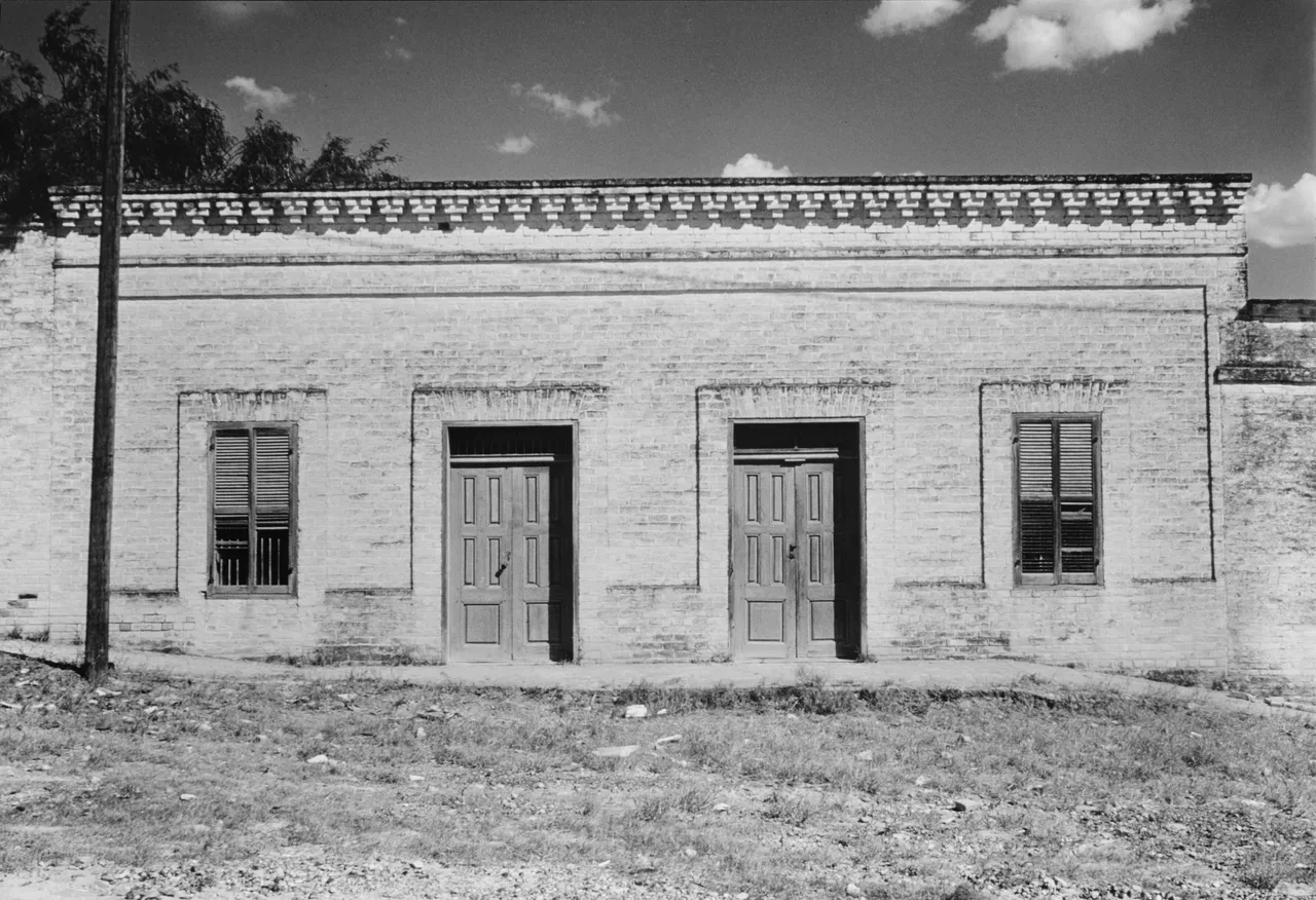
The plaza front of the Rafael García Ramírez house in Roma, photographed in July 1961 for the Historic American Buildings Survey. The National Historic Landmark nomination dates the building to about 1881 and attributes it to Heinrich Portscheller; the paired doors, the brick frames around each opening and the molded brick cornice are the kind of detail the nomination associates with his work. The nomination says the building was vacant in the early 1990s. W. Eugene George Jr., photographer, Historic American Buildings Survey (HABS TEX,214-ROMA,3-1), Library of Congress Prints and Photographs Division, via Wikimedia Commons, public domain.
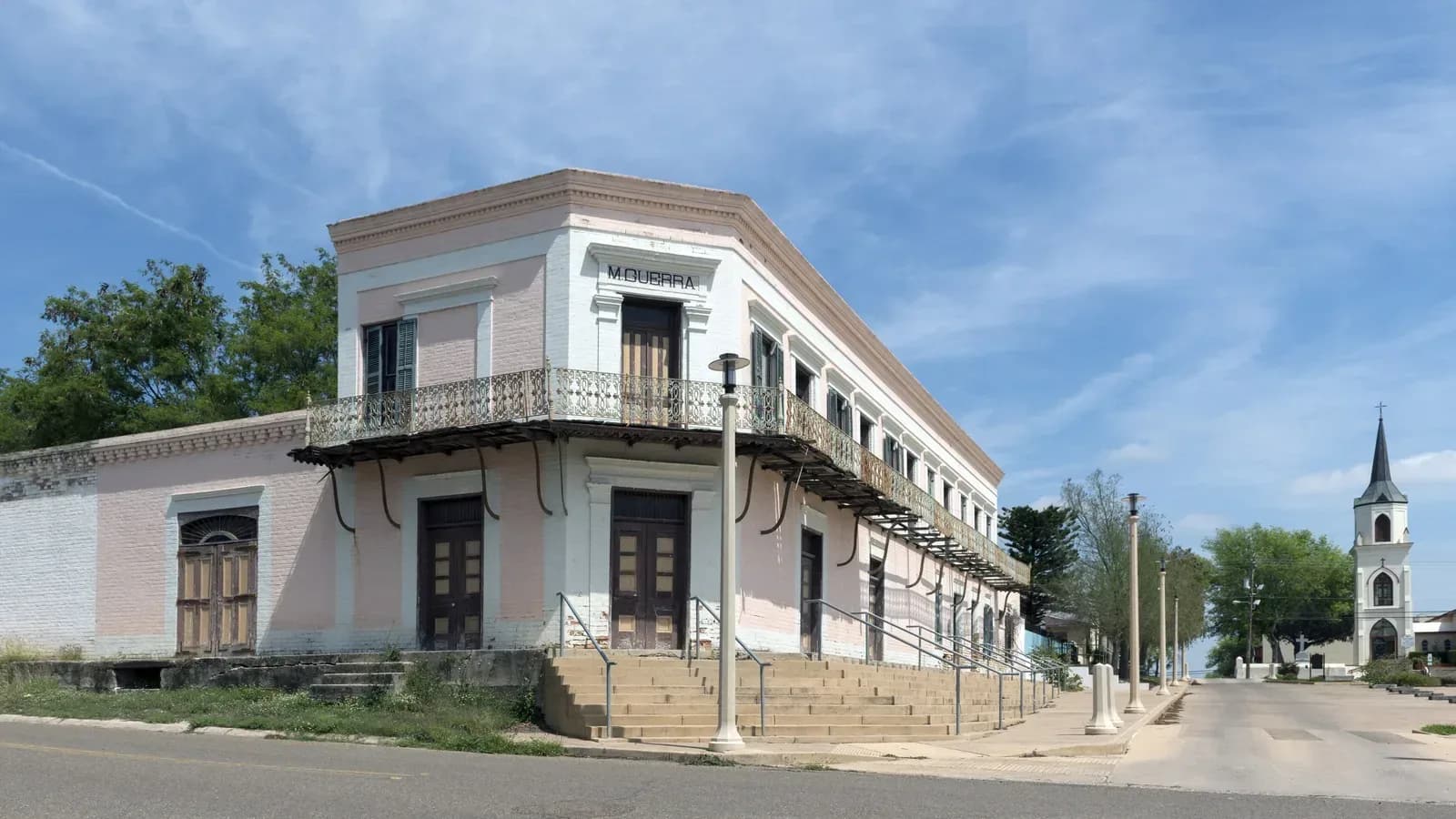
The biggest commission was Guerra’s. The nomination says that in 1884 Portscheller and Manuel Guerra signed a contract for a two-story house with a basement over a store, taking the whole plaza frontage of two lots. The family lived upstairs; the ground floor held a large store and an anteroom. Brick warehouses and an office filled out the lot, and an eight-foot wall enclosed it. The state marker calls it an early local example of sand-struck, hand-cast brick. [3] [16]
An American surveyor, W. H. Chatfield, saw the town in its prime and in 1893 called Roma “one of the most compact and picturesque towns of its size along the Rio Grande,” which some compared “to a hamlet on the Rhine.” The nomination puts the town at some 1,000 people at the time. The Sanborn-Perris fire insurance map of May 1894 gives 700 and notes no fire engines and no water facilities. The Handbook gives 521 for 1904. We print all three. That same year, 1894, an economic slump sent Portscheller to Laredo, where he died in 1915. [3] [20] [1] [8]
1894–1915: the Guerra years
Manuel Guerra was born in Mier in 1856. The Handbook says his family’s claim to land in South Texas went back to two Spanish grants in 1767 that straddled the river, and that, unlike many Hispanic families north of the border, the Guerras did not lose their land to Anglo ranchers and speculators. He settled in Roma in 1877, married Virginia Cox, and went into business and ranching. In 1894 he won a seat on the Starr County Commissioners Court and formed an alliance with Sheriff W. W. Shely. After Shely became incapacitated in 1905, the Handbook says, Guerra ruled for a decade as the political boss of Starr County. The Handbook’s county entry places his rise earlier, saying he asserted control in the 1870s and 1880s. [9] [2]
The Handbook describes his reign plainly: the mobilization of lower-class Mexican American laborers, “widespread corruption and outbursts of violence,” and an alliance with James B. Wells, the boss of Cameron County. Before the 1906 election both Guerra’s Democrats and Ed Lasater’s Republicans organized armed men; the district judge, a Democrat, was murdered in his sleep the night before the vote, and drunken rioting broke out in Rio Grande City. In January 1907 a Republican organizer and customs inspector, Gregorio Duffy, was killed in a gunfight involving Guerra’s cousin Deodoro, the new sheriff. A federal grand jury indicted Manuel and Deodoro Guerra, two deputies and a Texas Ranger for conspiracy to murder a federal official. All were acquitted in 1909. The county split in 1911, when Brooks County was formed from its northern part. [9] [2]
South Texas parties went by colors in those years. The county entry calls Guerra’s Democrats the Reds. The Handbook’s entry on the Reds and Blues says the colored ballots usually meant red for Republican and blue for Democrat, with the colors reversed in some counties. The two entries leave it unclear which color meant which party in Starr County, and we leave it there. [2] [10]
The nomination says the Guerra store printed its own currency and served as the economic center of the town at the turn of the century. Guerra died on June 9, 1915. His family, the Handbook says, kept control of Starr County politics until after World War II. [3] [9]
Roma was tied to Mexico’s revolutions as well as its own politics. The nomination says officials in Monterrey warned President Porfirio Díaz in 1885 that contraband weapons for a revolt were being stored in Roma, and that Roma was linked to arms storage and shipment again in 1911 and 1913. During the Mexican Revolution, the Handbook says, many refugees found shelter in the “Pink House”, later the Knights of Columbus Hall. In 1913 and 1914 Mexico again pressed its claim to Morteritos. [3] [1]
1925–1953: a bridge, oil and a dam
The railroad reached Rio Grande City in 1925, and roads followed to Roma. A bridge followed the roads. The Starr County Bridge Company and the Compañía del Puente de San Pedro de Roma built a 700-foot steel suspension bridge across the Rio Grande at the old San Pedro crossing. The Handbook dates it to 1927; the landmark nomination and the state’s 1996 marker say 1928. It was designed by engineer George Cole of Houston and built by Joseph Erastus Pate, and the nomination says Pate’s work crews were Mexican. The marker calls it the only surviving suspension bridge built on the U.S.–Mexico border and says the crossing has been in use “from prehistoric times to the present.” A new concrete bridge was built in 1979, and the nomination says modern traffic bypasses the old span. [1] [3] [19]
Oil and gas were found near Roma in the early 1930s, and oil-crew families moved in. The Handbook counts 1,000 people and thirty businesses in 1931. Melon-packing plants and two cattle-auction barns went up in the early 1950s. [1]
Then the river was tamed. Work on Falcon Dam upstream began in 1951. Presidents Dwight D. Eisenhower and Adolfo Ruiz Cortines dedicated the reservoir on October 19, 1953. The Handbook says the dam’s completion assured control of flooding around Roma. It also put Guerrero, one of Escandón’s towns, under water; the landmark nomination lists it among the old villas that did not survive. [11] [1] [3]
Hollywood came to the plaza for Viva Zapata!, the Marlon Brando film, which the Handbook says was made around the main plaza. The nomination says two signs painted for it, “Beer” and “Cantina,” were still on a plaza building in the early 1990s. [1] [3]
Kéralum’s church changed in these years too. The nomination says only the tower of the original Church of Nuestra Señora del Refugio survives; the nave was replaced in 1962 and the spire rebuilt as a smaller cone. The Handbook says the tower forms part of Our Lady of Refuge Church, dedicated in 1965. The two dates may describe construction and dedication; the sources do not say. [3] [1]
1972 to now: a landmark district
Roma’s old town was listed on the National Register of Historic Places on July 31, 1972. The Handbook says Roma was designated a national historic district in 1971, the year the Roma Historical Museum was organized in an 1840 building. On November 4, 1993, the Park Service made the district a National Historic Landmark. The nomination counts thirty-eight contributing resources, among them sixteen stone buildings from about 1829 to the 1870s, nineteen brick buildings from the 1880s to 1900, the plaza, the wharf site and the suspension bridge. It calls Roma “the prime specimen for the study of the historic architecture of the Lower Rio Grande.” [21] [1] [3]
The nomination was candid about the buildings’ condition: the Guerra store still held its old shelving, display cases and family business records, but the buildings were “deteriorating rapidly.” The Handbook says more than a dozen homes around the plaza had been restored and marked with state medallions. The City of Roma’s own historic-district page tells the town’s story as a nineteenth-century trade hub that moved Confederate cotton past the Union blockade. [3] [1] [22]
The county around Roma has known hard times. The Handbook says Starr County was among the poorest in the nation in the 1980s, with unemployment of 52.2 percent in January 1985, and that in 1993 it was the nation’s second-poorest county. Roma itself grew steadily. The Handbook gives 2,154 people in 1970 and 8,059 in 1990, and says a new water plant, an elevated tank, a fire and police building and a community center were built after 1979. Roma High School opened west of town in 1990. [2] [1]
The modern counts do not line up neatly. The Texas Almanac table on the Handbook’s page gives 9,617 in 2000, 9,765 in 2010, 11,484 in 2019 and 11,561 in 2020. The county entry gives 9,830 for Roma in 2014. The Census Bureau’s estimates start from a 2020 base of 11,524, which differs from the 2020 count, and put the town at 11,543 on July 1, 2025. We print the figures as published and do not reconcile them. [1] [2] [23]
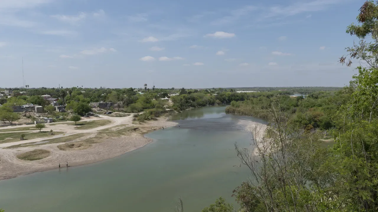
The Rio Grande from the bluffs above Roma, looking toward Mexico, photographed March 15, 2014. The nomination describes the Roma site by its high sandstone bluffs and an ancient river crossing. The photographer’s title says only that the view is of Mexico; it does not identify the buildings on the far bank. Carol M. Highsmith, Lyda Hill Texas Collection of Photographs in Carol M. Highsmith’s America Project, Library of Congress Prints and Photographs Division (LCCN 2014631832), public domain.
Roma was not the only Texas river port where the water dropped and the railroad passed it by; Dock Line told that story in Jefferson, in Northeast Texas. What sets Roma apart, by the Park Service’s account, is how much of the river-trade town still stands. [3]
The complete story of Roma
It is the story of a salt road and a ford that Escandón’s surveyors called the Pass of the Mules, and of native people the records do not name. It is the story of ranch families from Mier who took up long strips of land north of the river in 1767 and lived as if the Rio Grande were not a border, because for them it was not. It is the story of Texans who camped on the bank in 1842 and drew beans in Mexico, of a French priest who designed a church and vanished on the road, and of steamboats that came up as far as Roma and no farther. It is the story of cotton smuggled past a blockade, of contraband in both directions, of a German brick mason who built for merchant families, and of a political boss whose store printed its own money. The steamboats are gone and the river is lower. The plaza still faces Mexico.
Questions people ask
How did Roma, Texas, get its name? The Handbook says the place was called Buena Vista and then Garcia Ranch, and was renamed Roma in 1848 at the suggestion of the Oblates of Mary Immaculate. The National Park Service’s landmark nomination says Stephen F. Austin labeled the site Roma on a map in an 1823 letter, so the name may be older than the Handbook says. [1] [3]
When was Roma founded? It depends on the source. The Handbook dates the first Saenz settlement to the mid-1760s or about 1763; the porciones were granted in 1767; the nomination says families occupied them by about 1770; and some sources give 1821. [1] [2] [3]
What is the Roma Historic District? The old town around the plaza, listed on the National Register in 1972 and designated a National Historic Landmark on November 4, 1993, with thirty-eight contributing resources including the 1884 Manuel Guerra residence and store and the suspension bridge. [21] [3]
Is the old Roma bridge still standing? It was when the state marked it in 1996. The marker says the 700-foot steel suspension bridge, built in 1928 (1927 in the Handbook), is the only surviving suspension bridge built on the U.S.–Mexico border. A new concrete bridge was built in 1979. [19] [1]
What is Roma’s ZIP code? 78584. Roma is in southwestern Starr County on U.S. Highway 83, across the Rio Grande from Ciudad Miguel Alemán, Tamaulipas. [3] [1] [24]
Sources
Dick D. Heller Jr., “Roma-Los Saenz, TX,” Handbook of Texas Online, Texas State Historical Association, revised June 1, 1995. tshaonline.org/handbook/entries/roma-los-saenz-tx. The entry’s bibliography includes Virgil N. Lott and Mercurio Martinez, The Kingdom of Zapata (Naylor, 1953), Jovita González, Social Life in Cameron, Starr, and Zapata Counties (M.A. thesis, University of Texas, 1930) and the General Land Office’s Guide to Spanish and Mexican Land Grants in South Texas (1988). The page also carries the Texas Almanac’s population table.
Alicia A. Garza, “Starr County,” Handbook of Texas Online, revised April 6, 2019. tshaonline.org/handbook/entries/starr-county.
Karen J. Weitze, with Michael R. Corbett, edited by James H. Charleton, “Roma Historic District,” National Historic Landmark nomination, National Park Service (Dames & Moore, Inc.); designated a National Historic Landmark November 4, 1993. npgallery.nps.gov/NRHP/GetAsset/NHLS/72001371_text. The nomination’s own sources include W. H. Chatfield, The Twin Cities of the Border and the Country of the Lower Rio Grande (1893), John Reps (1979) and Historic American Buildings Survey records for Roma.
Clotilde P. García, “Escandón, José de,” Handbook of Texas Online, revised October 1, 1995. tshaonline.org/handbook/entries/escandon-jose-de. Its bibliography includes Hubert J. Miller, José de Escandón, Colonizer of Nuevo Santander (Nuevo Santander Press, 1980) and Florence J. Scott, Historical Heritage of the Lower Rio Grande (1937; rev. ed. 1966).
Joseph M. Nance, “Mier Expedition,” Handbook of Texas Online, revised April 8, 2020. tshaonline.org/handbook/entries/mier-expedition. Its bibliography includes Thomas J. Green, Journal of the Texian Expedition Against Mier (1845) and Nance, Attack and Counterattack (University of Texas Press, 1964).
William L. Watson, O.M.I., “Oblates of Mary Immaculate,” Handbook of Texas Online, revised September 29, 2015. tshaonline.org/handbook/entries/oblates-of-mary-immaculate.
Robert E. Wright, O.M.I., “Kéralum, Pierre Yves,” Handbook of Texas Online, published March 1, 1995. tshaonline.org/handbook/entries/keralum-pierre-yves. Its bibliography includes Bernard Doyon, The Cavalry of Christ on the Rio Grande, 1849–1883 (Bruce, 1956).
Eugene George, “Portscheller, Heinrich,” Handbook of Texas Online, revised April 26, 2016. tshaonline.org/handbook/entries/portscheller-heinrich.
Evan Anders, “Guerra, Manuel,” Handbook of Texas Online, revised December 8, 2019. tshaonline.org/handbook/entries/guerra-manuel. Its bibliography includes Anders, Boss Rule in South Texas: The Progressive Era (University of Texas Press, 1982).
Cynthia E. Orozco, “Reds and Blues,” Handbook of Texas Online. tshaonline.org/handbook/entries/reds-and-blues.
Dick D. Heller Jr., “International Falcon Reservoir,” Handbook of Texas Online, revised February 1, 1995. tshaonline.org/handbook/entries/international-falcon-reservoir.
Texas Historical Commission, “Mission Mier a Visita” (marker 3405, 1936), Texas Historic Sites Atlas. atlas.thc.texas.gov/Details/5427003405.
Texas Historical Commission, “Nuevo Santander Land Grants” (marker 17720, 2013), Texas Historic Sites Atlas. atlas.thc.texas.gov/Details/5507017720.
Texas Historical Commission, “The Mier Expedition” (marker 5380, erected by the State of Texas, 1936), Texas Historic Sites Atlas. atlas.thc.texas.gov/Details/5427005380.
Texas Historical Commission, “First Chapel in Roma” (marker 1697, 1973), Texas Historic Sites Atlas. atlas.thc.texas.gov/Details/5427001697.
Texas Historical Commission, “Manuel Guerra Home and Store” (marker 3200, 1973), Texas Historic Sites Atlas. atlas.thc.texas.gov/Details/5427003200.
Texas Historical Commission, “Heinrich Portscheller” (marker 16204, 2008), Texas Historic Sites Atlas. atlas.thc.texas.gov/Details/5507016204.
Texas Historical Commission, “Ramirez Hall” (marker 4174, 1973), Texas Historic Sites Atlas. atlas.thc.texas.gov/Details/5427004174.
Texas Historical Commission, “Roma-San Pedro International Bridge” (marker 14683, Recorded Texas Historic Landmark, 1996), Texas Historic Sites Atlas. atlas.thc.texas.gov/Details/5507014683.
Sanborn-Perris Map Co., Roma, Starr Co., Tex., May 1894, one sheet. Library of Congress Geography and Map Division, Sanborn Maps collection (sanborn08726); via Wikimedia Commons. commons.wikimedia.org.
National Park Service, National Register of Historic Places, “Roma Historic District,” NRIS 72001371, listed July 31, 1972. npgallery.nps.gov/AssetDetail/NRIS/72001371.
City of Roma, “Historic District.” cityofroma.net/residents/historic-district.
U.S. Census Bureau, Population Estimates Program, “City and Town Population Totals: 2020–2025” (sub-est2025.csv), row for Roma city, Texas. www2.census.gov. See also QuickFacts: census.gov/quickfacts/romacitytexas.
Texas Department of Transportation, Highway Designation File, U.S. Highway 83. dot.state.tx.us/tpp/hwy/us/us0083.htm.
Carol M. Highsmith, “The Manuel Guerra residence and store building in the historic district of Roma, a small city along the Rio Grande River in Starr County, Texas,” March 15, 2014. Lyda Hill Texas Collection of Photographs in Carol M. Highsmith’s America Project, Library of Congress Prints and Photographs Division (LCCN 2014631835). lccn.loc.gov/2014631835.
Carol M. Highsmith, “A look at Mexico from bluffs above Roma, a small but historic city along the Rio Grande River in Starr County, Texas,” March 15, 2014. Library of Congress Prints and Photographs Division (LCCN 2014631832). lccn.loc.gov/2014631832.
W. Eugene George Jr., photographer, “North Elevation (Plaza), Rafael Garcia Ramirez House, East side of Main Plaza at Hidalgo, Roma,” July 1961. Historic American Buildings Survey, HABS TEX,214-ROMA,3-1, Library of Congress Prints and Photographs Division; via Wikimedia Commons. commons.wikimedia.org.
Texas Historical Commission, “Noah Cox House” (marker 6055, 1963, Recorded Texas Historic Landmark), Texas Historic Sites Atlas. atlas.thc.texas.gov/Details/5427006055.